

Your Trusted Source for
Accurate Weather Forecasts.
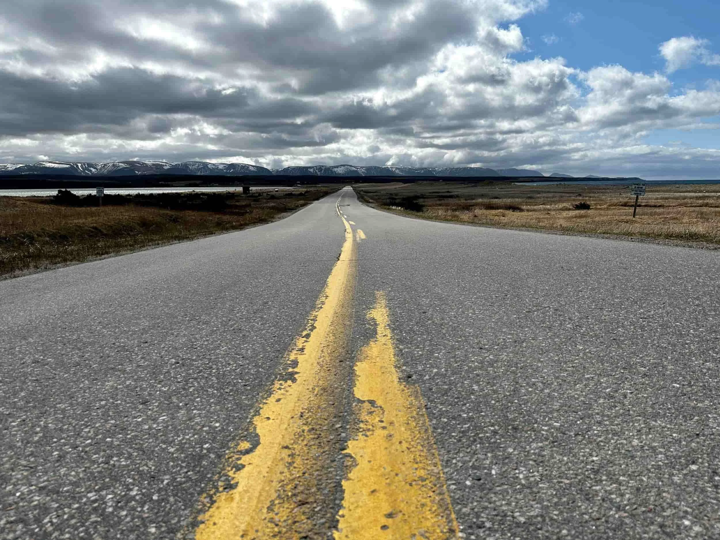
Hyper-Local. Accurate. Always Free.
When it comes to Newfoundland and Labrador’s unpredictable weather, you need forecasts you can count on. Sheerr Weather delivers real-time updates, expert analysis, and storm alerts—all tailored to the unique weather patterns of our region— and delivered by someone who lives through NL weather with you.
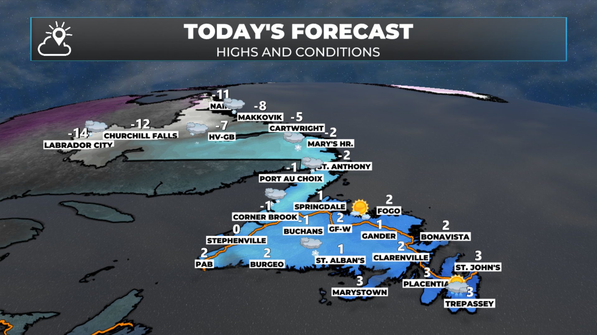
Provincial Forecast
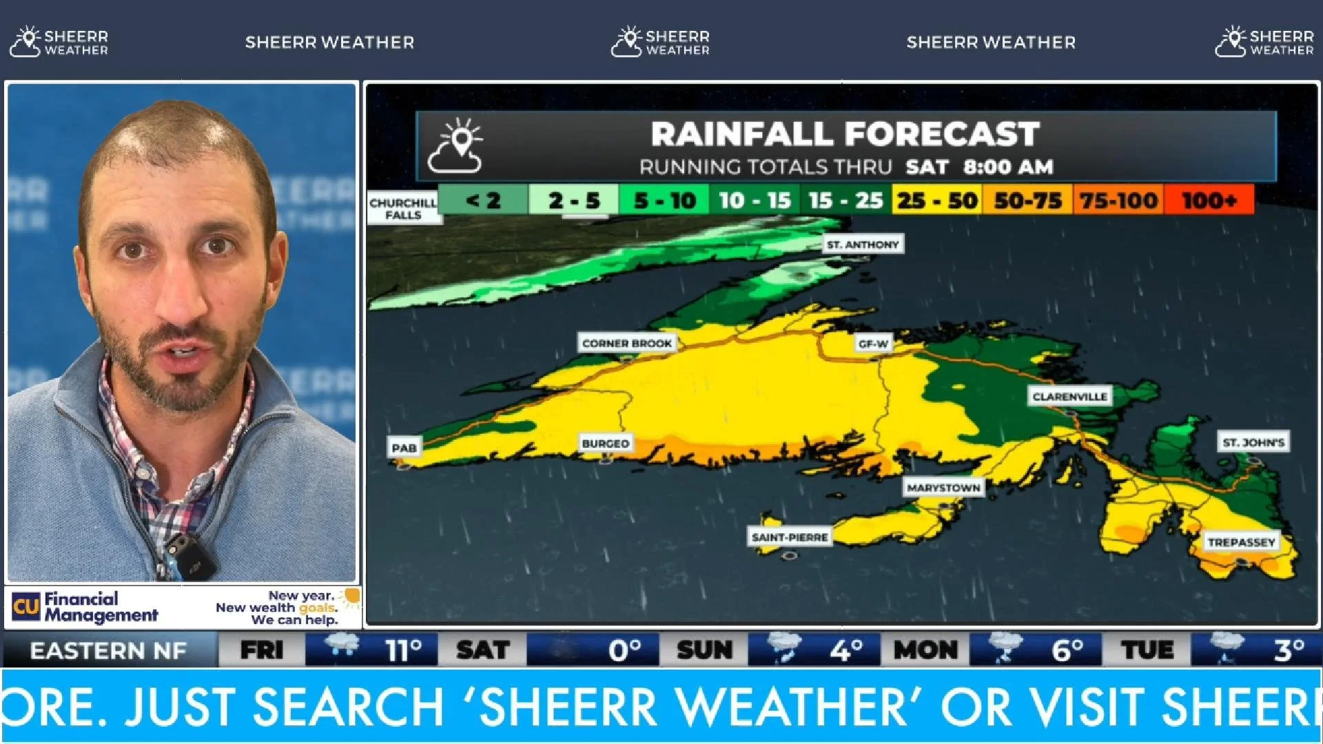
Catch Eddie’s daily video updates for an expert breakdown of today’s forecast. The latest forecast for NL can ALWAYS be found right here.
Regional Forecasts
The Blog
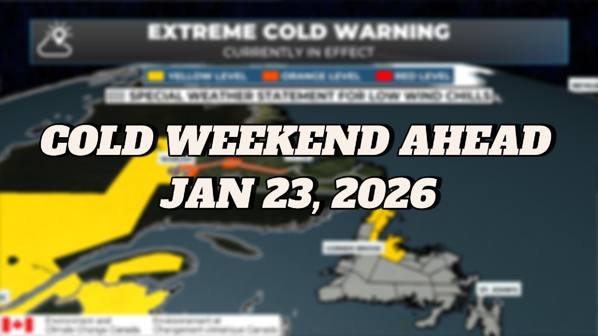
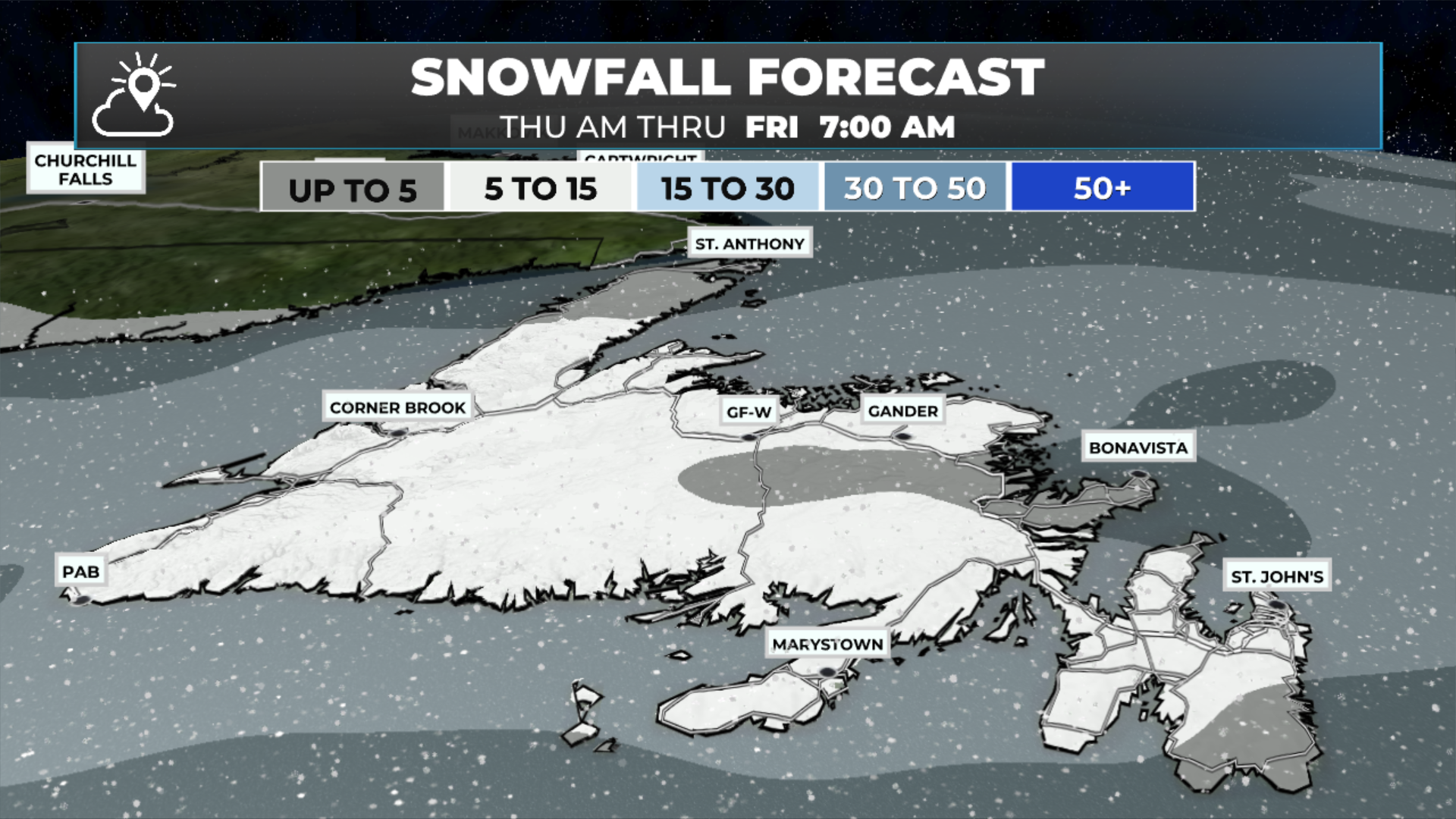
Arctic Air and Snow Squalls Settle In For The Weekend
Arctic air settles in and will make for a very cold weekend across NL!
NL Hydro Issues Second ‘Power Watch’ for Island Customers Friday Morning
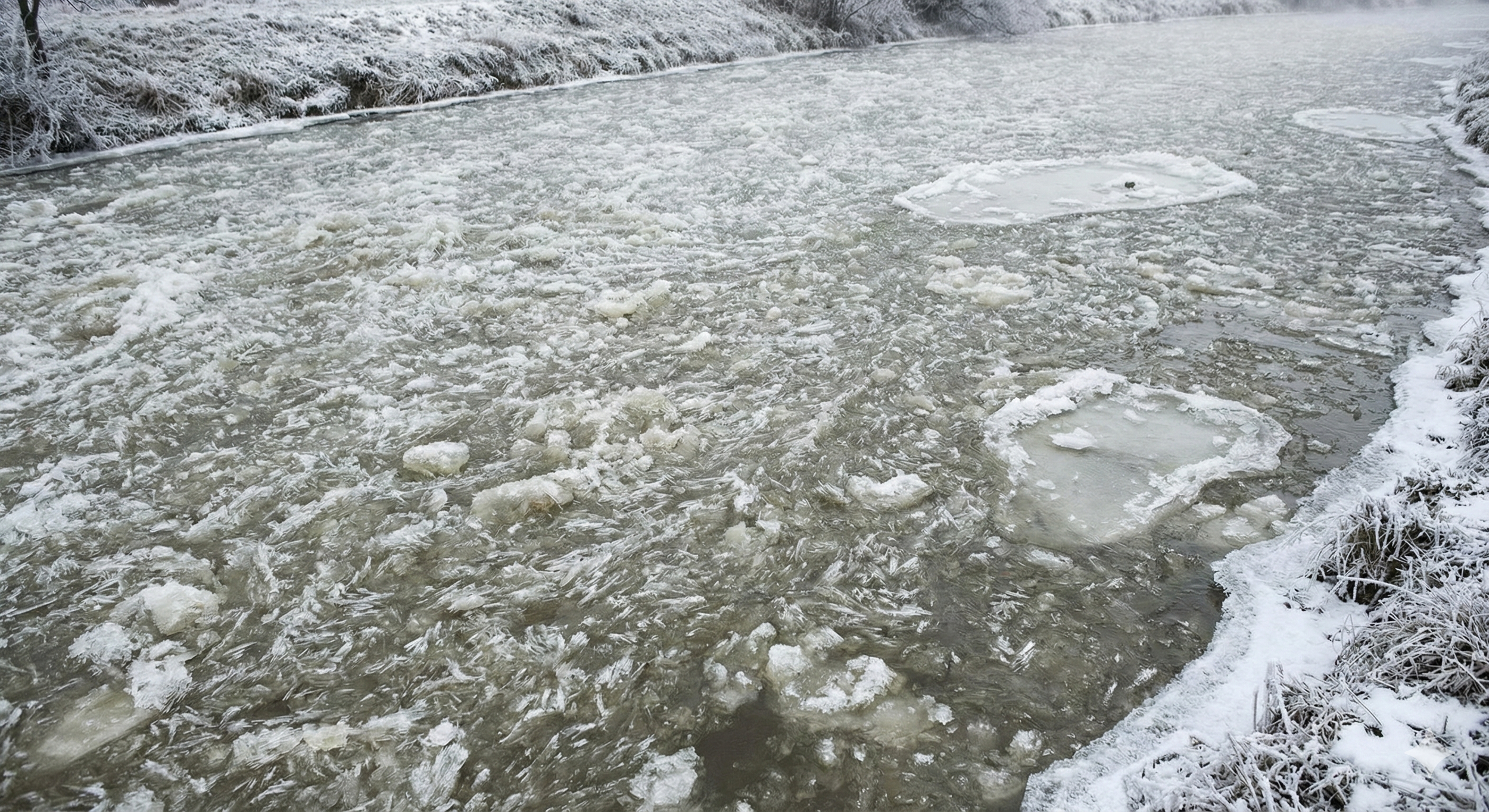
Frazil ice at the Bay d’Espoir system has caused NL Hydro to issue a second Power Watch for Island customers, beginning this morning.
Cold Eases in Labrador, Snow Moves Into Newfoundland — More Uncertainty Ahead
The weather will not be as impactful over the next couple of days, but there is still activity to talk about.
NL Hdryo Issues ‘Power Watch’ for Island Customers Beginning Thursday Morning
Frazil ice at the Bay d’Espoir system has caused NL Hydro to issue a Power Watch for Island customers, beginning this morning.
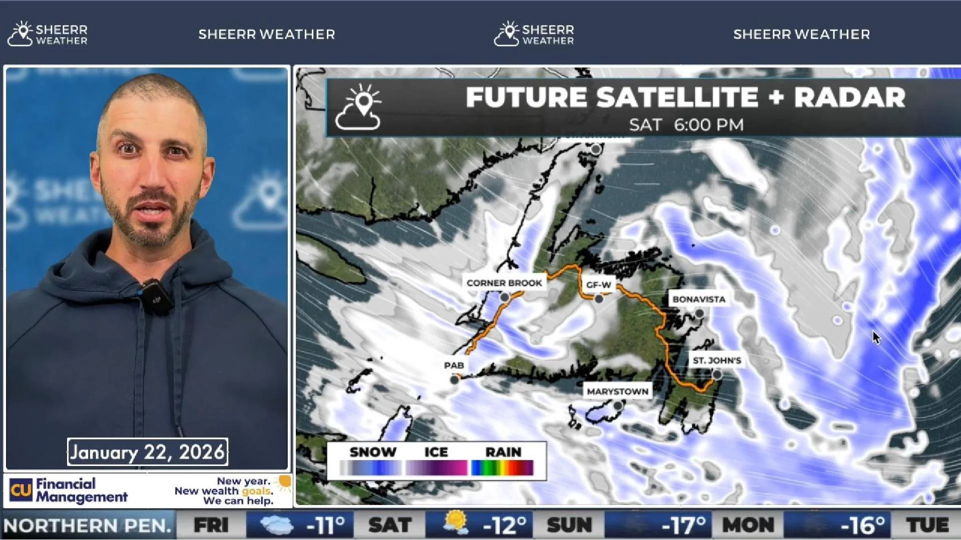
Thursday Morning Update — January 22, 2026
Good morning! Here are today’s weather details!
Snow Flurries and Squalls Ease By Thursday Morning, Ahead of Next Weather-Maker
Snow flurries and squalls ease overnight as our next weather-maker begins to move in.
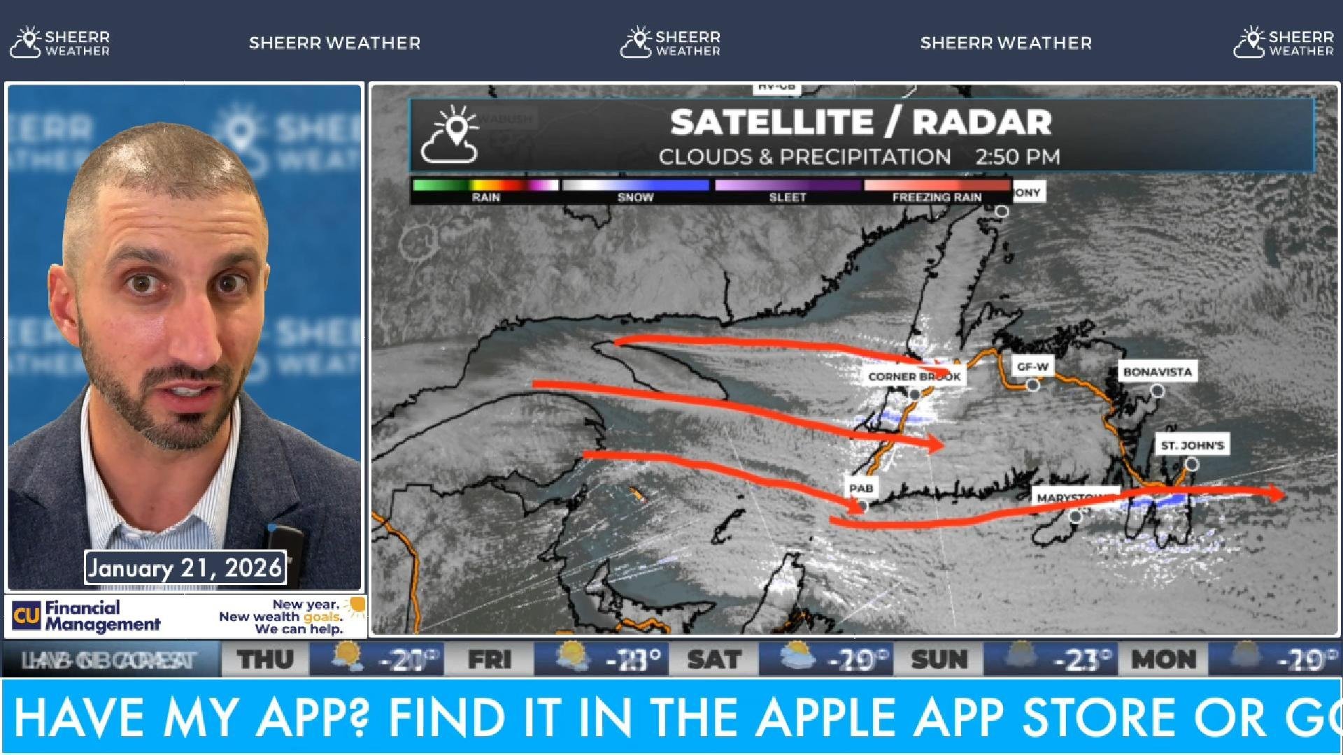
Wednesday Morning Update — January 21, 2026
Arctic air settles in and snow squalls will be rampant across much of Newfoundland today!
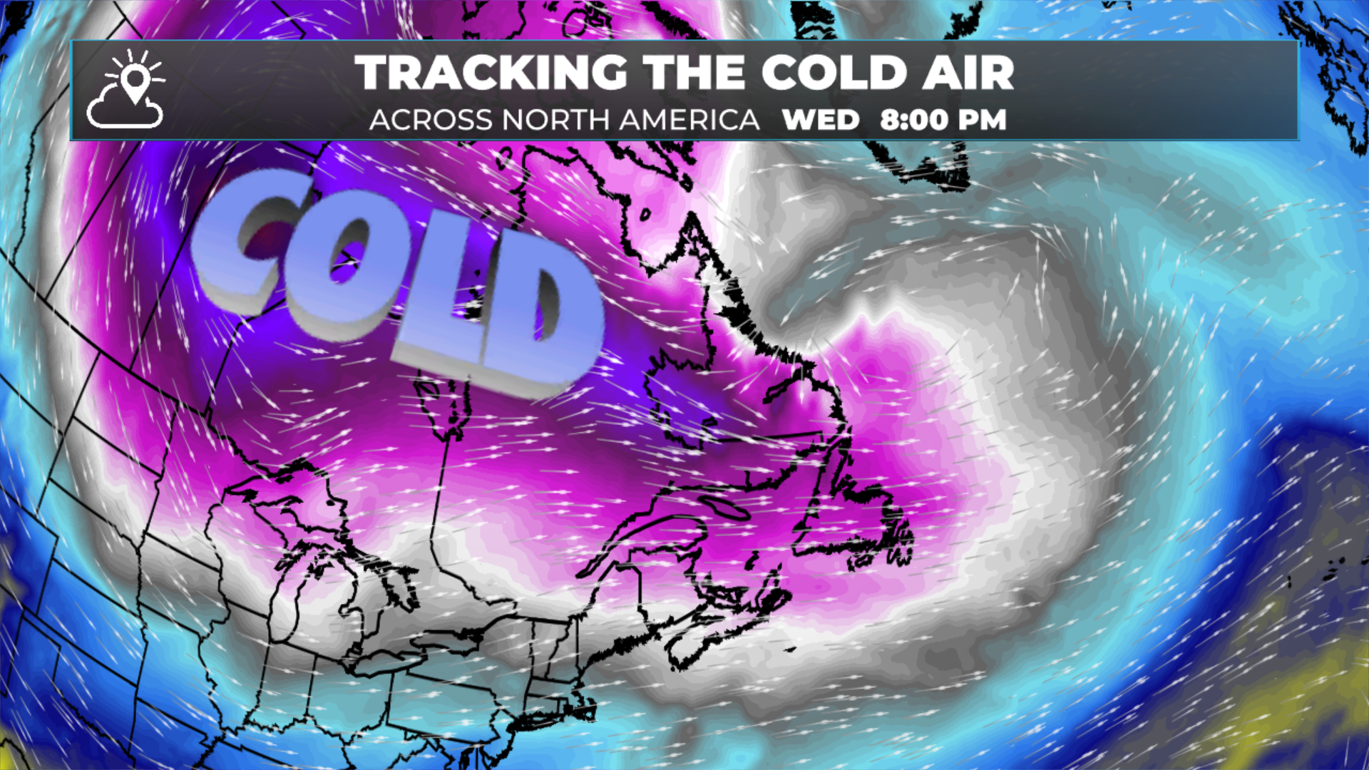
Bitter Cold, Dangerous Wind Chills, and Snow Squalls Ahead
The coldest air of the winter arrives overnight…
Tuesday Morning Update — January 20, 2026
A deep dive into Tuesday’s forecast, and a bit about the rest of the week!
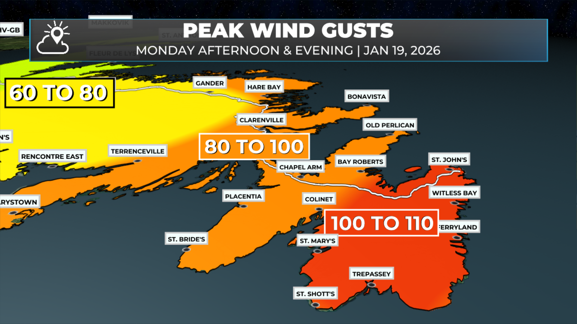
Wind Speeds Ramp Up (Again) As Current Storm Departs This Evening
Wind speeds ramp up this afternoon and evening over eastern Newfoundland, before quickly coming down before midnight.

Monday Morning Update — January 19, 2026
Another weather-maker moves through today and brings snow, rain and wind to much of Newfoundland and parts of Labrador.

Winter Storm, Snowfall, Rainfall, Wind Warnings, Along With Special Weather Statements in Effect for Monday
Another winter storm rolls in overnight Sunday night.

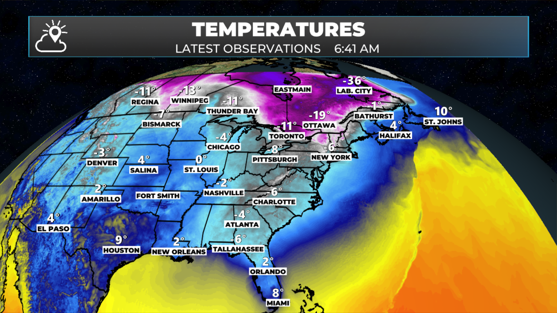
Record Temperatures, High Winds, Heavy Rainfall Highlight NL’s Latest Storm Summary From Environment Canada
High winds, heavy rain and record temperatures are all part of the latest storm summary issued by Environment Canada.
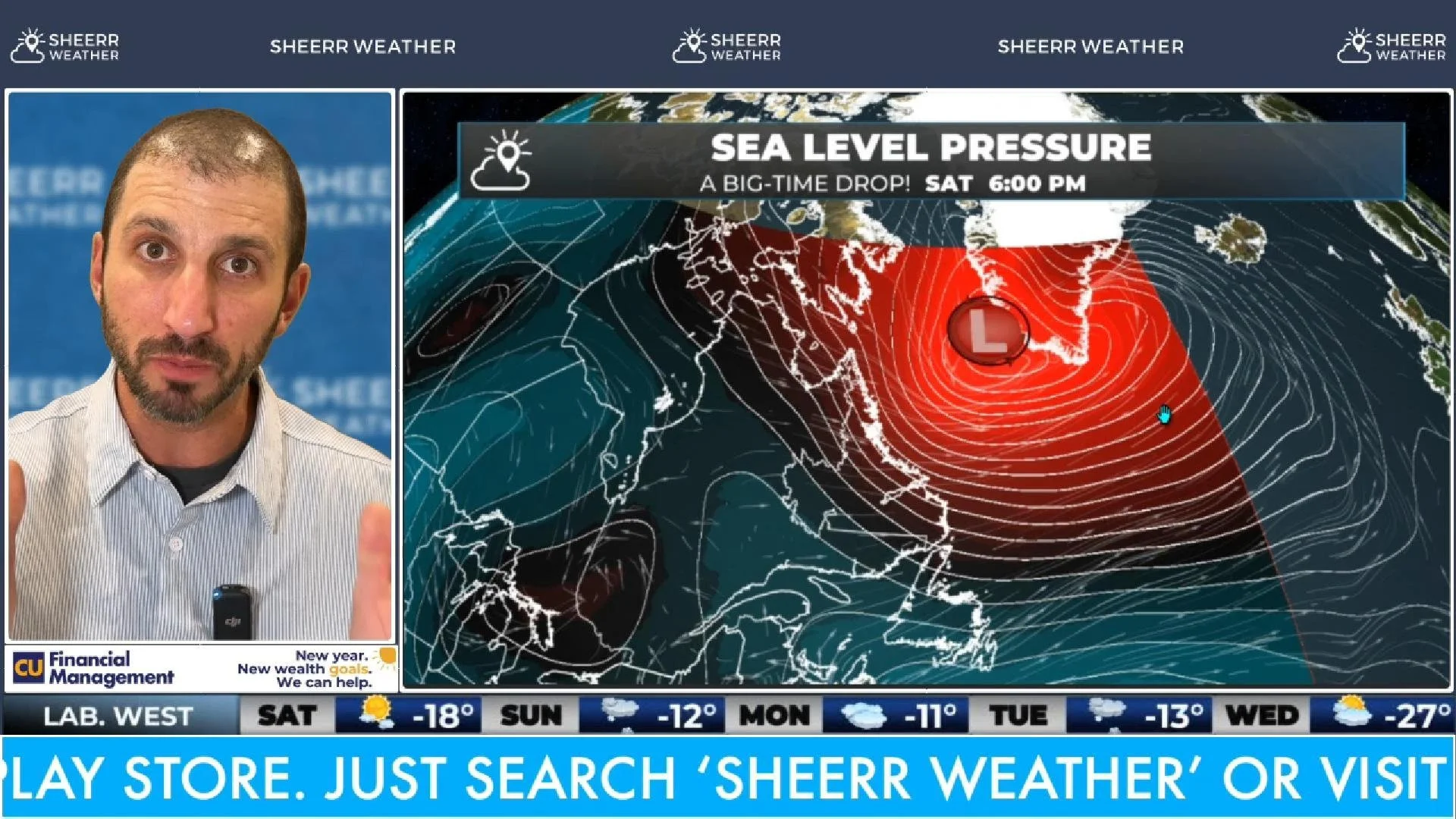
Wild Temperature Swings, Snow Moving In, and Wind on the Way
The warm air departs and the cold air moves in… the wind sticks around as we head into the weekend!
Friday Morning Update — January 16, 2026
Another rain, wind and snow-maker is going to hang around through our Friday and Friday night.
January Thaw Lingers Into Friday On the Island While Winter Weather Takes Hold in Labrador
Snow, rain and wind are in the forecast once again!
Thursday Morning Update — January 15, 2026
Another round of active weather arrives this morning.

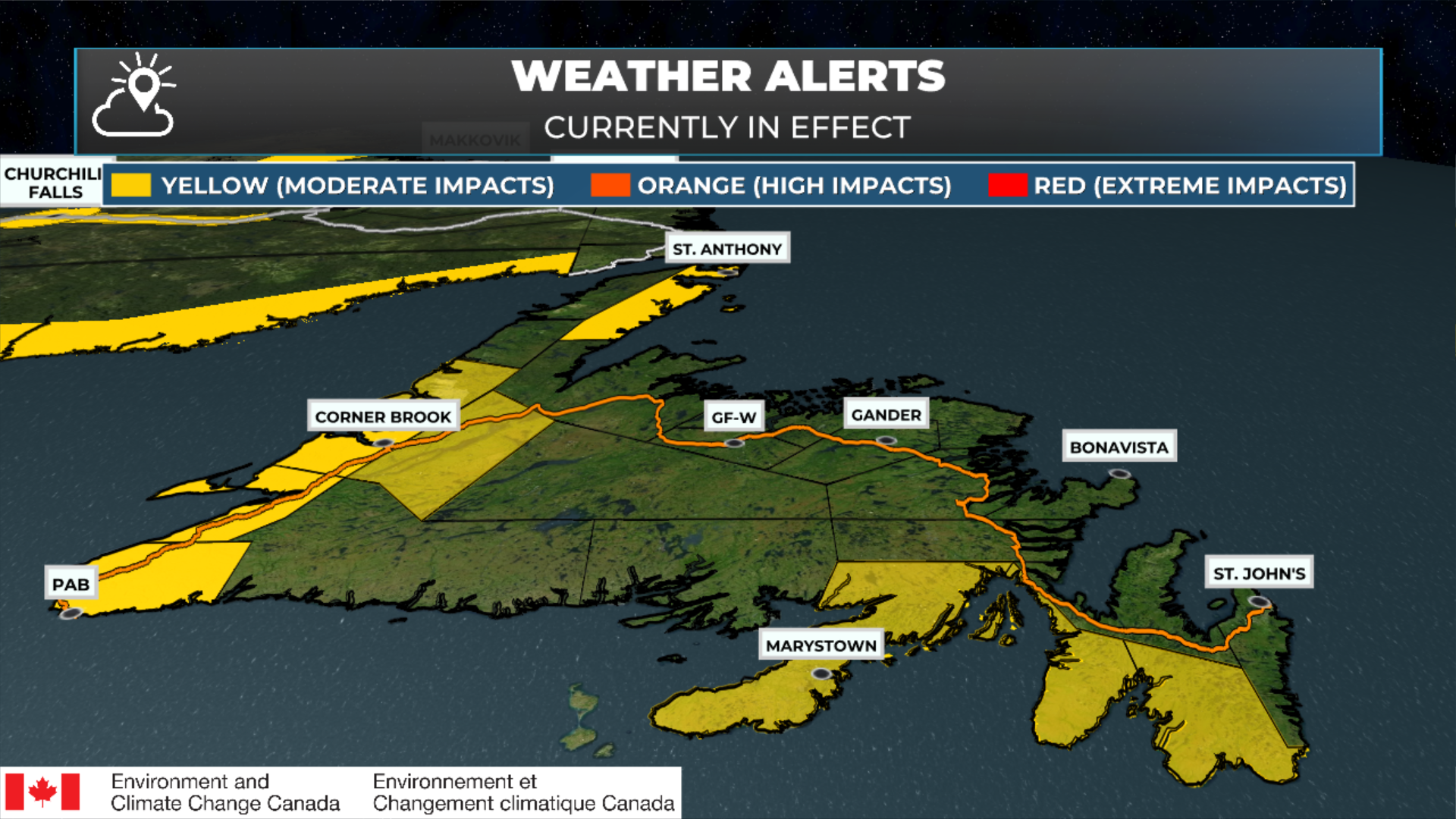
Much of NL Under Weather Alerts Until Late Friday or Saturday
Various alerts are in effect between today and Saturday
Temps in the Teens, Wind and Rain For Newfoundland Thursday and Friday, While Snow Flies In Labrador
Many of us will see teens tomorrow and/or Friday!
Setting A New Standard for Forecasts in NL…
Accurate, Hyper-Local: I live in the weather here, just like you.
Real-Time Alerts: Stay informed with push notifications.
Community-Focused: From Torbay to the Torngats, your home matters to me.
AVAILABLE NOW!!!

Coming Soon!
Coming Soon!
Coming Soon!

Wonderin’ which coat to put on?
Get the forecast with the Sheerr Weather App, wherever and whenever you need it.
Love what we’re doing?
Help us keep providing free, hyper-local weather information for everyone in Newfoundland and Labrador.
Advertisers: Explore Sponsorship/Advertising Opportunities
Environment Canada issued a ‘weather summary’ earlier today, highlighting the snowfall amounts and maximum wind gusts from our latest high-impact winter storm.