

Your Trusted Source for
Accurate Weather Forecasts.
Hyper-Local. Accurate. Always Free.
When it comes to Newfoundland and Labrador’s unpredictable weather, you need forecasts you can count on. Sheerr Weather delivers real-time updates, expert analysis, and storm alerts—all tailored to the unique weather patterns of our region— and delivered by someone who lives through NL weather with you.
Provincial Forecast
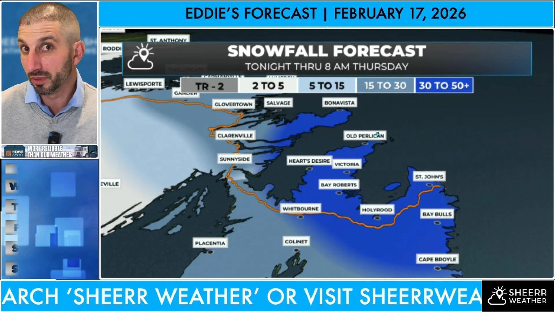
Catch Eddie’s daily video updates for an expert breakdown of today’s forecast. The latest forecast for NL can ALWAYS be found right here.
Regional Forecasts
The Blog
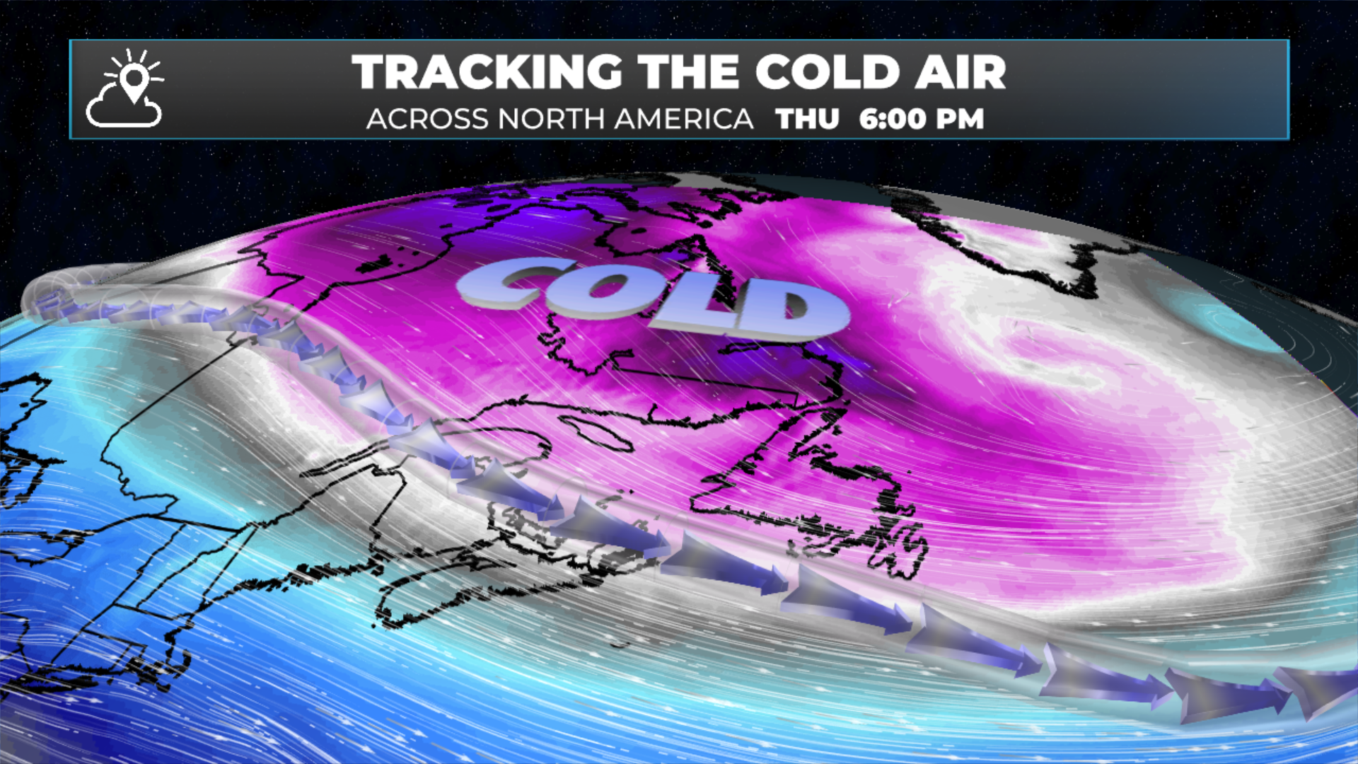
Snow Continues Wednesday Afternoon Ahead of Thursday’s Arctic Blast
Snow has arrived…. the arctic air is next!
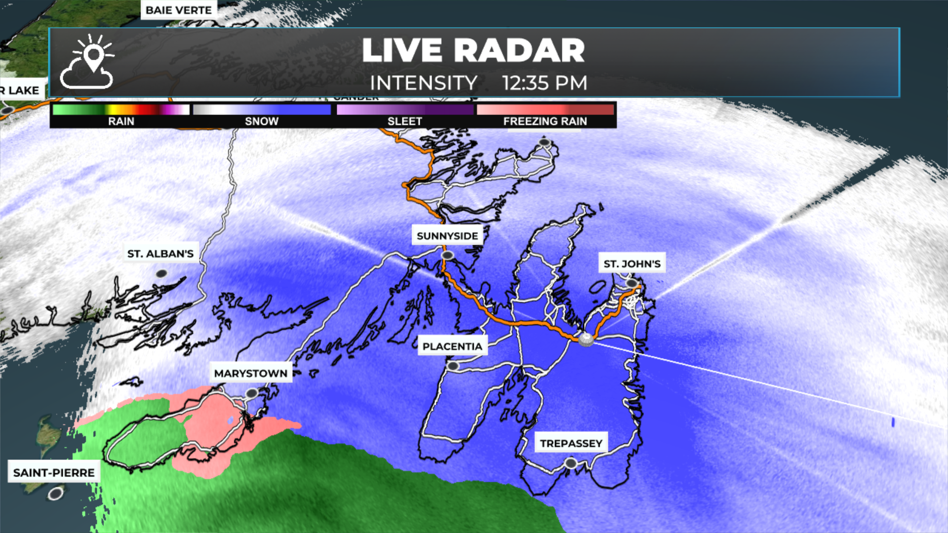
Another Round Of Snow For Wednesday — Followed By More Arctic Air Thursday
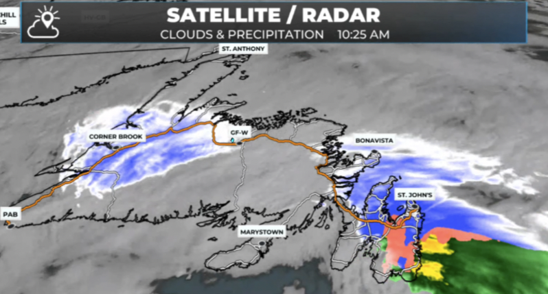
A developing low pressure system to our south will track from near western Nova Scotia in the morning to southeastern Newfoundland by evening. That puts us back into a more active pattern for the middle of the week.
February Ends On A Quiet Note Across The Province
St. John’s has a new snowfall record in the books as quiet weekend… mostly… awaits much of NL!
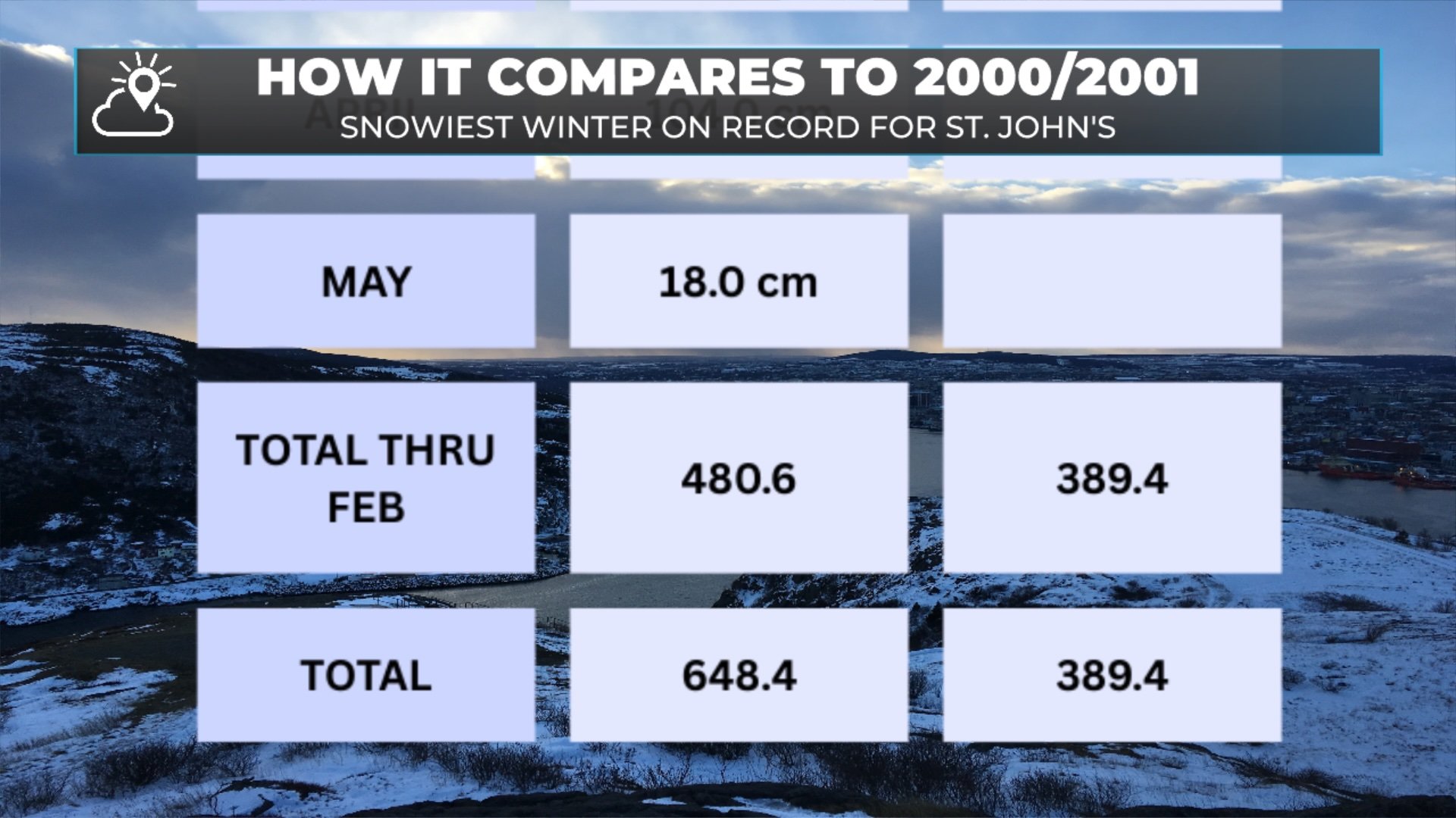
A Month for the Record Books in St. John’s as the latest low departs NL
Looks like St. John’s has not only seen its snowiest February on record, but the snowiest MONTH on record as well, thanks to the latest low to swing across NL.
Low Pressure Lingers Tonight — Another Round of Snow on the Way Thursday
As one weather-maker moves out, another has sights set on the region for Thursday.
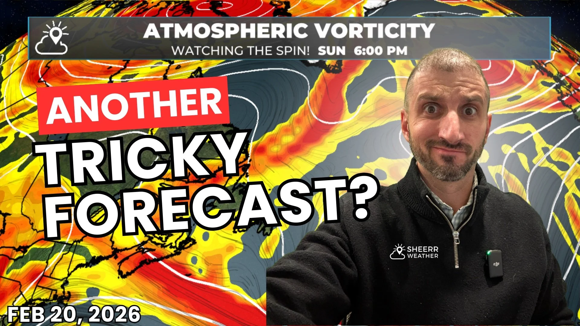
This Weekend’s Forecast Isn’t Lacking Snow or Forecast Challenges for NL
Another tricky forecast is in the cards for the weekend.
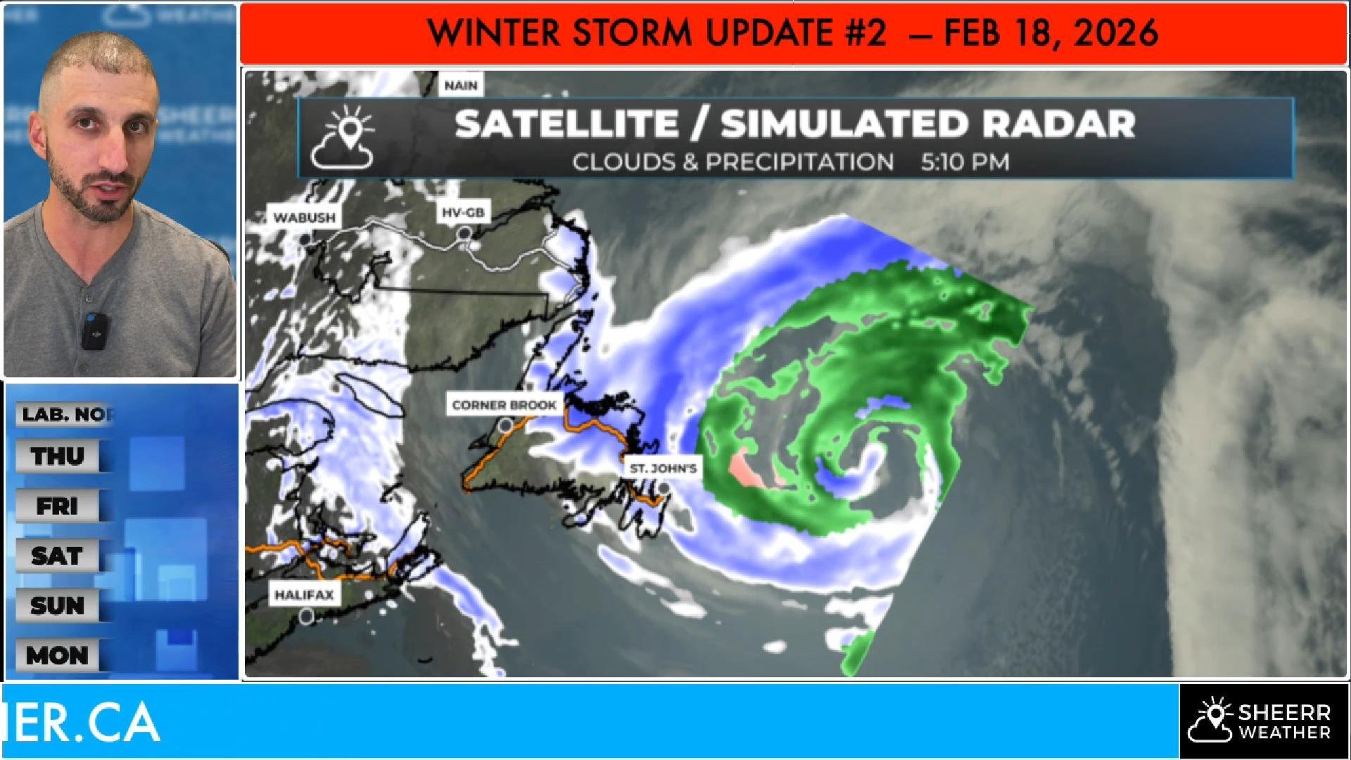
Winter Storm Update: We’re Not Done Yet
Our winter storm continues into tonight, and up to 20 cm of additional snow will fall on the Avalon and northeast coast…
Major Winter Storm Arrives This Evening, Brings Heavy Snowfall, High Winds to Eastern Newfoundland
Heavy snow rolls in tonight, and high winds follow on Wednesday. Snow continues into Thursday. Lots of details in this evening’s forecast!
Coastal Flooding & Higher-Than-Normal Water Levels Expected Monday–Tuesday
Higher-than-normal water levels are expected along several coastal areas of Newfoundland as a strong winter storm moves through early this week. The greatest concern will be around times of high tide, when storm surge and large waves combine.
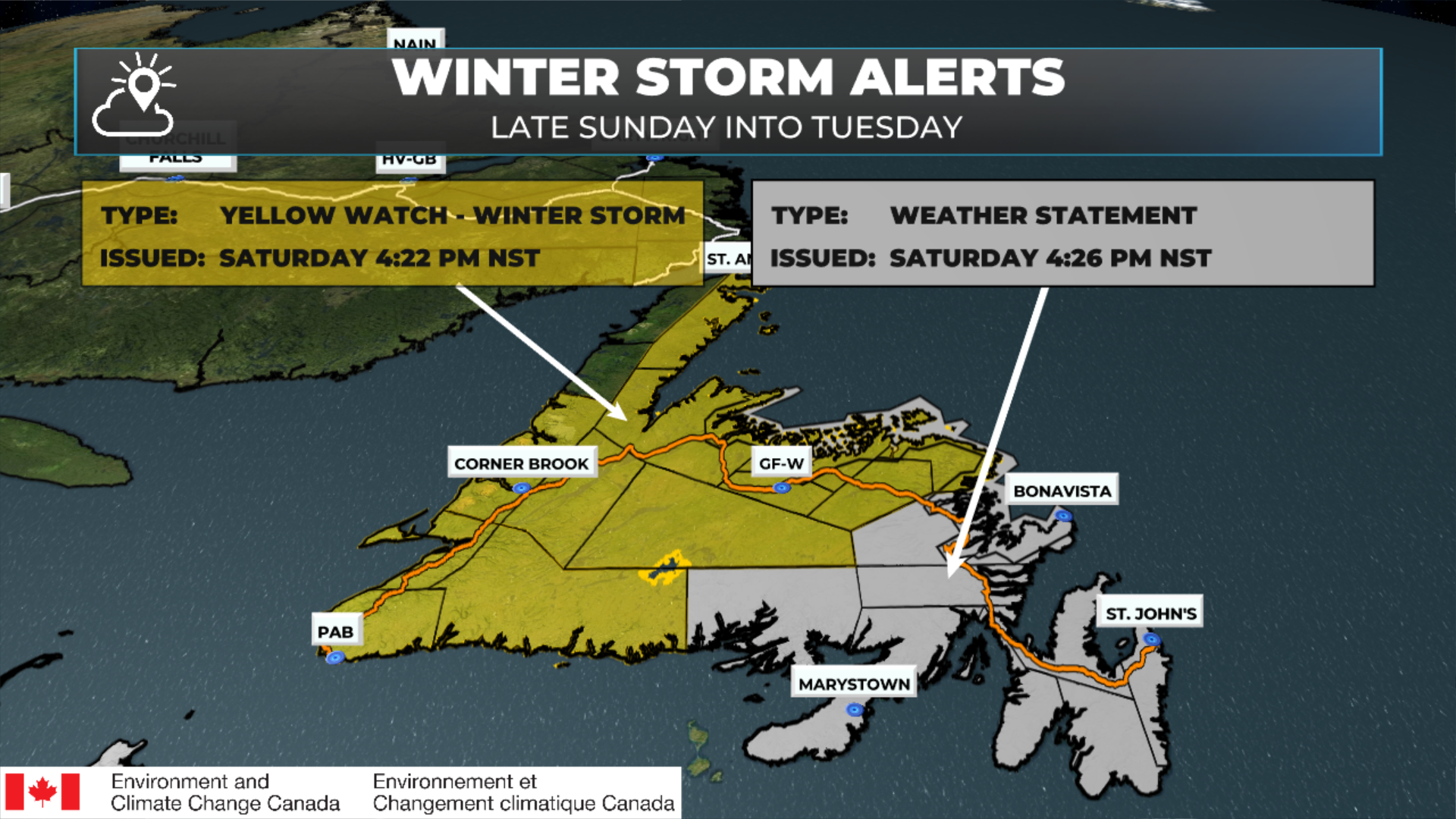
UPDATED | Environment Canada issues Winter Storm Watch, Special Weather Statement and Coastal Flood Statements for Monday into Tuesday
The next winter storm arrives Sunday night and lasts into Tuesday. It will bring high winds, heavy snow and rain to much of Newfoundland.

Winter Storm Expected Wednesday — Environment Canada Issues Special Weather Statement
Environment and Climate Change Canada has issued a Special Weather Statement for Wednesday, as a potent winter storm is expected to bring heavy snow, rain and high wind to Newfoundland.
Setting A New Standard for Forecasts in NL…
Accurate, Hyper-Local: I live in the weather here, just like you.
Real-Time Alerts: Stay informed with push notifications.
Community-Focused: From Torbay to the Torngats, your home matters to me.
AVAILABLE NOW!!!


Coming Soon!
Coming Soon!
Coming Soon!

Wonderin’ which coat to put on?
Get the forecast with the Sheerr Weather App, wherever and whenever you need it.
Love what we’re doing?
Help us keep providing free, hyper-local weather information for everyone in Newfoundland and Labrador.
Advertisers: Explore Sponsorship/Advertising Opportunities
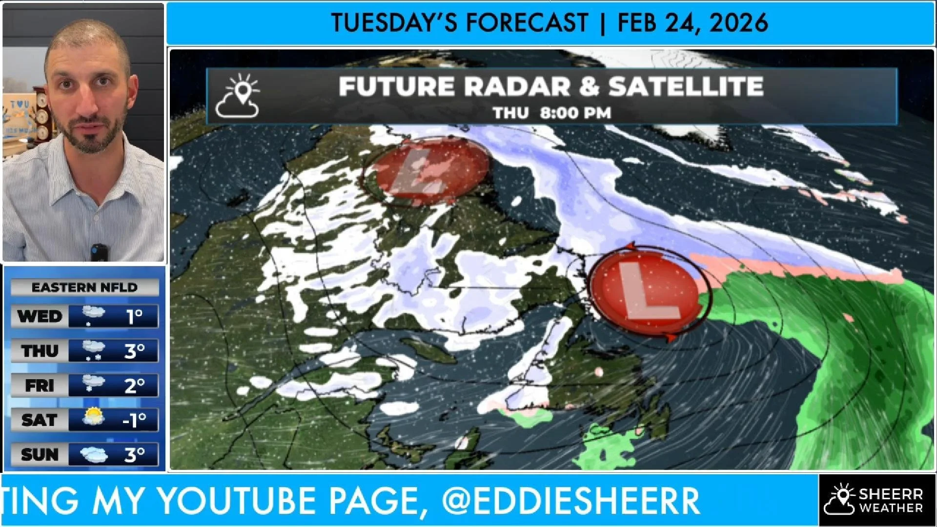
Here is a look at Tuesday’s forecast!