
Tuesday morning weather brief — September 9, 2025
Good Tuesday morning!
We are waking to a cooler and drier air mass over the region. When I say air mass, what I mean is the type of air over the area and where it came from. Yesterday, the air over the area was coming up from the tropics (almost), and today the air is from the continent. This means as you’re stepping out the door this morning, it is not nearly as muggy as it was yesterday. The animation below shows this very well. The bright colours represent air with high humidity. The blue colours indicate air with lower humidity levels.
This drier air moved in behind a cold front. The cold front slipped through last evening on the Avalon and you may have noticed it. The temperatures didn’t drop, but the dew point did. The observations went from 21º with a dew point of 19º at 5:30 PM to 18º with a dew point of 12º at 8:30 PM. As of 5:30 AM today, the temperature is 13.8º with a dew point of 12º, and while that does make the relative humidity high, it is still not feeling as muggy as yesterday. The warmer the air, the more moisture it can hold, and the difference in dew points leads to a 67% reduction in the amount of moisture the air can hold!
A line graph showing the temperature and dew points observations at St. John’s for the las 24 hours.
This update is sponsored by Roebothan, Mckay, Marshall, Accident and Injury Law.

Visit MakeTheCall.ca to learn more about what the law firm can do for you.
Today’s Forecast
Across the Province today, we are looking at generally quiet weather. Most areas will be sunny with highs into the teens and lower 20s with a few caveats. Those will be:
Eastern Newfoundland
The Burin, Bonavista, and Avalon Peninsulas.
Stubborn cloud cover in this area will lead to mostly cloudy skies today. Clouds will clear this afternoon for the Burin and Bonavista Peninsula, and late afternoon or early evening on the Avalon.
Labrador West
The day will start sunny, but clouds and showers will return this afternoon.


After Today…
A Frost Advisory is in effect tonight for parts of interior and central Newfoundland. Lows are forecast to be as low as 0º in the coolest low-lying sheltered locations. If you have sensitive plants and live in a place like Badger, expect near-freezing temperatures tonight.

Tomorrow (Wednesday) will be sunny to partly cloudy and dry across most of the Province with highs in the mid-teens to about 20º. There will be a few afternoon showers and thunderstorms that roll into Labrador West along a cold front. That front is with a low that will slowly move across Labrador on Thursday and bring widespread rain to much of the eastern and interior areas east of Labrador West. At the same time, there will be a low-pressure centre to the southeast of Newfoundland that will bring some rain to the Avalon and Burin Peninsulas.
The low over Labrador will move over the Island on Friday as the offshore low moves away. This will bring widespread showers to the Island on Friday. At this time, it looks like those showers will move offshore Friday afternoon or evening, setting us up for a nice weekend across the Province.
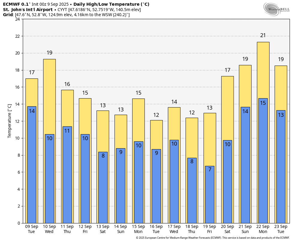
Temperatures this week look cooler and more seasonable with highs in the middle to upper teens or even low 20s, instead of the 20s. In fact, as of this writing, there is one out of the next 10 with a high temperature of at least 20º in the forecast for St. John’s. We need one more day to break the all-time record (as I discussed yesterday).
I’ll have more details on the longer-range forecast in this afternoon’s full forecast.
Have a great day!
Eddie