
Thursday Morning Weather Brief — September 11, 2025
Good Thursday morning!
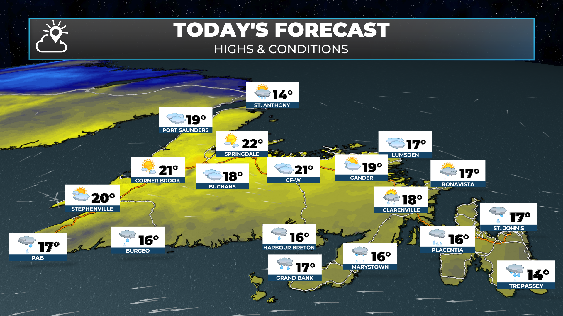
The weather across the Province this morning is generally on the quiet and cool side. We are looking at temperatures in the teens and single digits as of 5:30 AM. The cool spot in the Province looks to be Deer Lake, where the temperature was reported at 3º.

This morning’s update is sponsored by Roebothan, McKay, and Marshall.

Visit MakeTheCall.ca to learn more about what this accident and injuary law firm can do for you.
Most areas are dry this morning, althought some showers were reported in parts of nothern and western Labrador overnight. That will change in a hurry this morning as rain and showers push onto the coast of Labrador (from the west) and rain starts to spread onto the Island (from the south). The rain we are going to see on the Island today is currently located south-southwest of Newfoundland and is movoing north. The radars is Nova Scotia and Holyrood are doing a good job picking it up this morning.

Today will be a little cooler than the last couple days for much of the Province as an unsettled and more damp weather pattern sets in for the next 2 days. Expect highs on the Island in the middles teens to near 20, while teens and single digits will be common throughout Labrador.

The weather pattern we have over NL today is slightly complex. We have an upper-level low moving through Labrador, while at the same time, a surface low is going to make its way near and over the southeast Avalon this afternoon and tonight. The combination of these will bring rain to much of the Big Land, along with southern and eastern Newfoundland. The rain will be heavy at times.
These two pieces of energy will hook up, or phase, tonight, which will expand the rain over the Island to encompass more of it, while at the same time, the rain sinks south out of Labrador and ends completely by Friday morning. Friday will be unsettled, breezy, cool, and either showery or rainy for most of the Island. The weather will improve on Friday night.

RDPS Model’s forecast rainfall from today thru early Saturday morning (Sep 11 - 13, 2025)
Rainfall amounts don’t look overly significant for most areas, with 10 to 20 mm being a common forecast over the next 24 to 48 hours. Some pockets of higher amounts are possible, especially over the southeast corner of the Island and for areas that see heavy downpours.
My next update will be up this afternoon. Have a great Thursday!