
Monday Morning Weather Brief — September 8, 2025
Good Monday Morning
It is a very warm and very humid start to the day for the eastern half of Newfoundland. As of 5:30 AM many locations were reporting temperatures in the upper teens to near 20º, with humidex values in the middle and upper 20s. The western half of the Island is not quite as warm due to numerous showers and areas of rain, but it is very humid, with humidex values in the lower to mid-20s, with air temperatures in the teens.

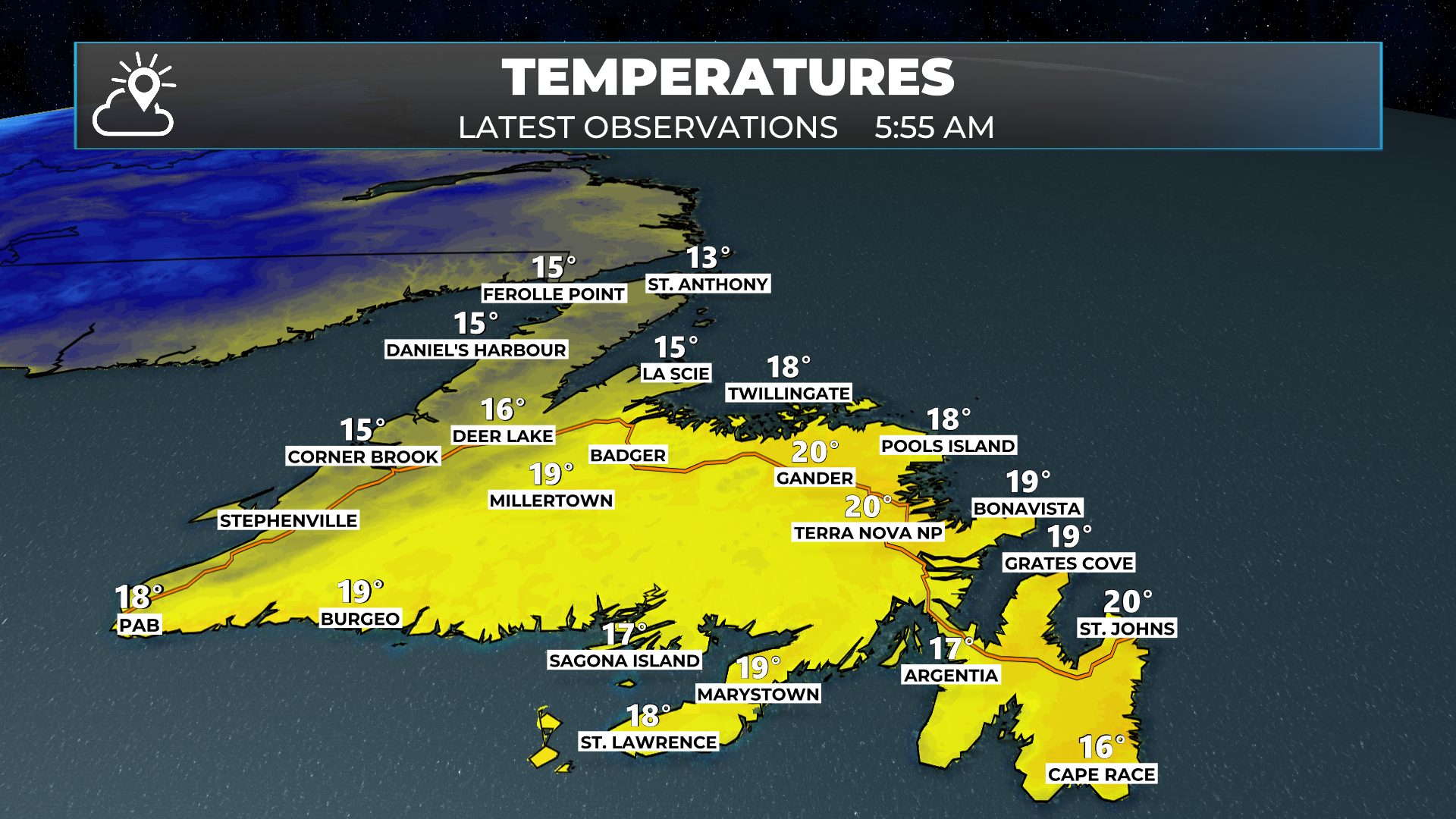
Temperatures today will climb into the mid-20s for the warmest areas of the Island and will hold into the teens and lower 20s in the cooler areas. Labrador will see highs into the teens and lower 20s in the east and southeast, cooling to single digits to lower teens in the north and west.

This morning’s update is sponsored by Roebothan, McKay and Marshall.

Visit MakeTheCall.ca to learn more about what the law firm can do for you.
Along with the warm temperatures, we are seeing areas of rain and showers draped across the western half of the Island at this early hour, along and near a cold front. Some of the rainfall rates within these showers are quite high, due to the moisture available to work with in the atmosphere. This radar image from just before 6 AM shows where the showers are located quite well.
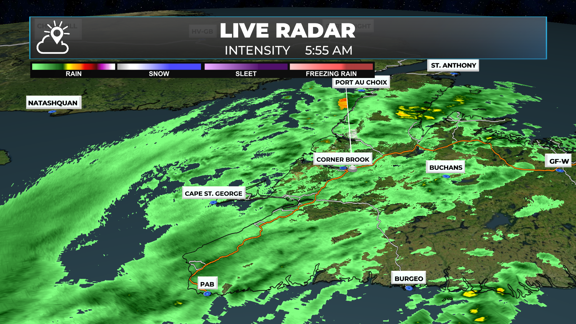
We are also seeing some showers near and over eastern Newfoundland at this hour. And they are primarily located over the Burin and Avalon Peninsulas. These showers, like the ones on the Wese Coast and GNP, are moving from southwest to northeast.

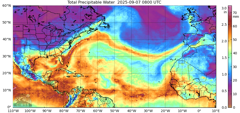
Part of the reason the showers are producing such high rainfall rates this morning is the air mass that is over the region— it’s a very humid one with tropical origins. The animated GIF below shows precipitable water and where it’s being advected (pushed) towards in the atmosphere. Notice the brighter colours over parts of Newfoundland? That’s the signal that a) it’s very humid and b) we are likely to see areas of very dense fog along and near southern-facing shores this morning.
Once the sun comes up a bit more, be sure to check on the road cameras to confirm my thoughts on the fog!
On top of all that, we are also looking at showers and pockets of rain over the Big Land this morning, along with temperatures in the upper single digits to lower teens. It is coolest in the west and north and warmest in the east and south. The showers that we are seeing on the Island will move toward the east this morning and will ease later today. The showers we are seeing in Labrador West at this hour will also move to the east throughout the day. The animation below depicts this very well.
The showers and areas of rain we are seeing are along a cold front, and that front will move east of most of the region later today and tonight. This will set us up for a sunnier and much drier Tuesday. We will also get some relief from the warm overnight temperatures as well, tonight, with temperatures forecast to drop into the mid-teens in the east. So once the rain showers end today, open up the windows if you find your house a bit warm!
I’ll have my full forecast for you later today. Until then, have a great day and be sure to check back for updates!