
Thursday Morning’s Weather Briefing — May 7, 2026

This morning’s update is sponsored by Roebothan, McKay, Marshall.

Visit MakeTheCall.ca today to learn more about how the law firm can help you!
Good Thursday morning!
Here are today’s highlights:
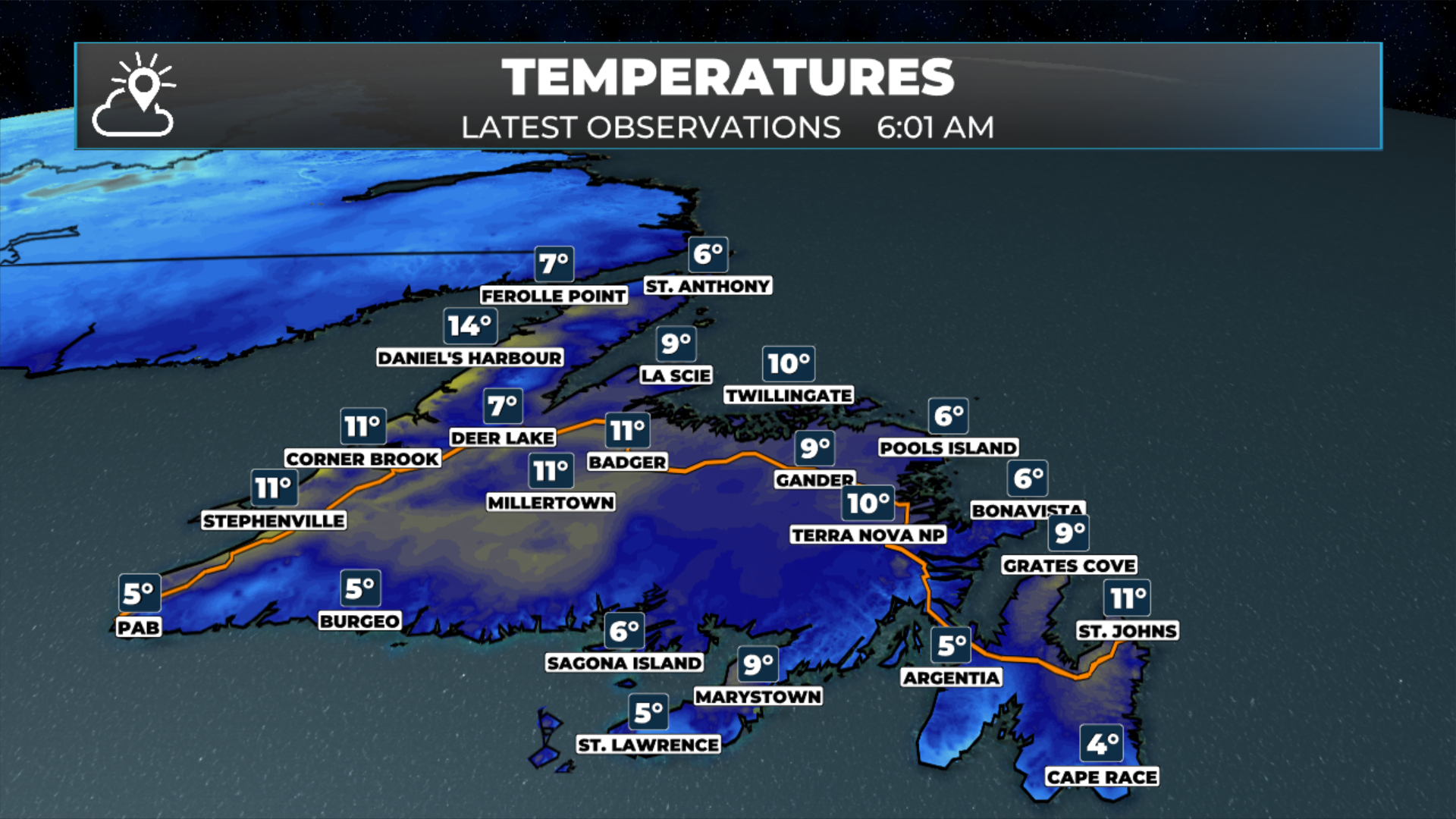
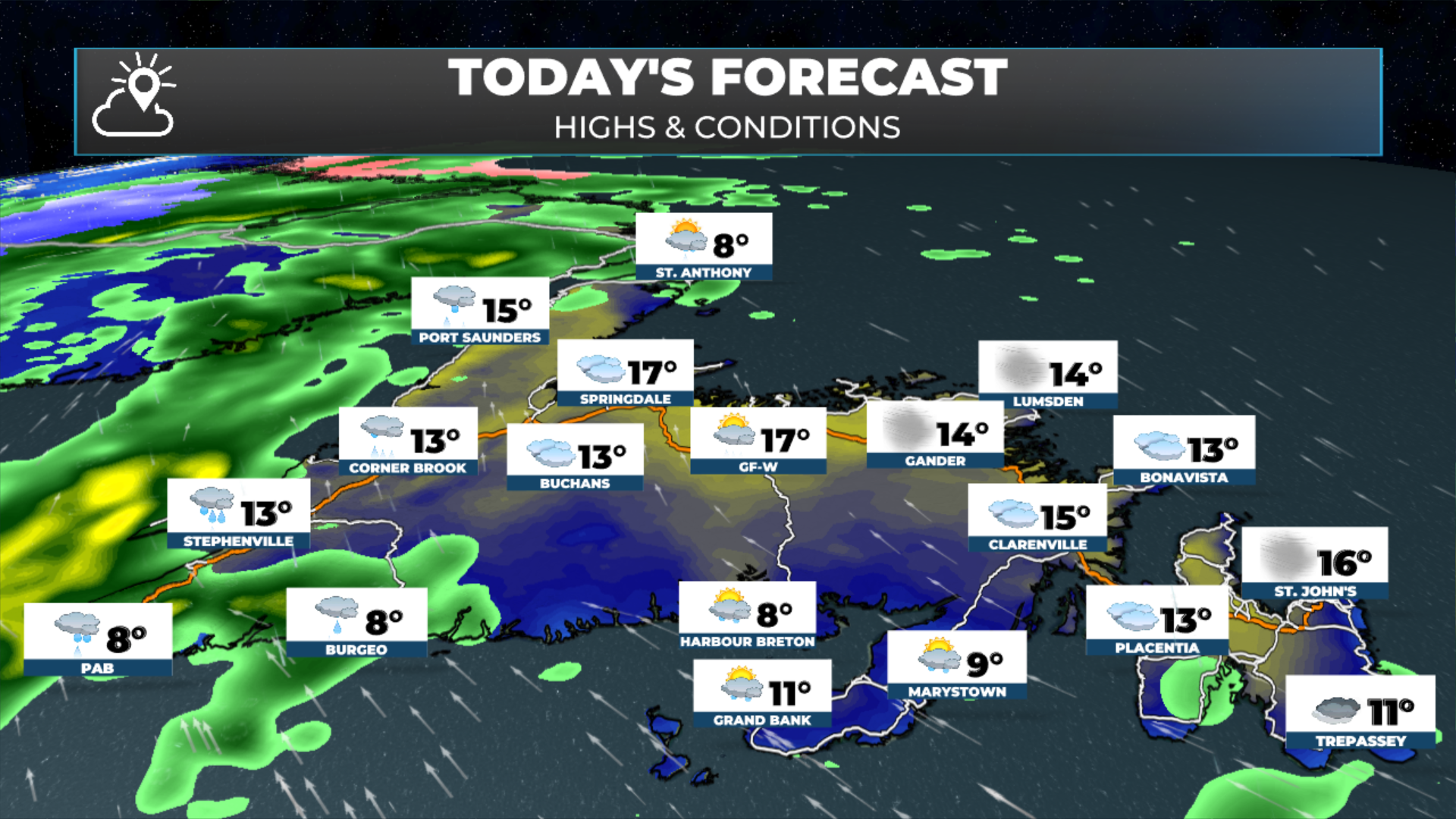
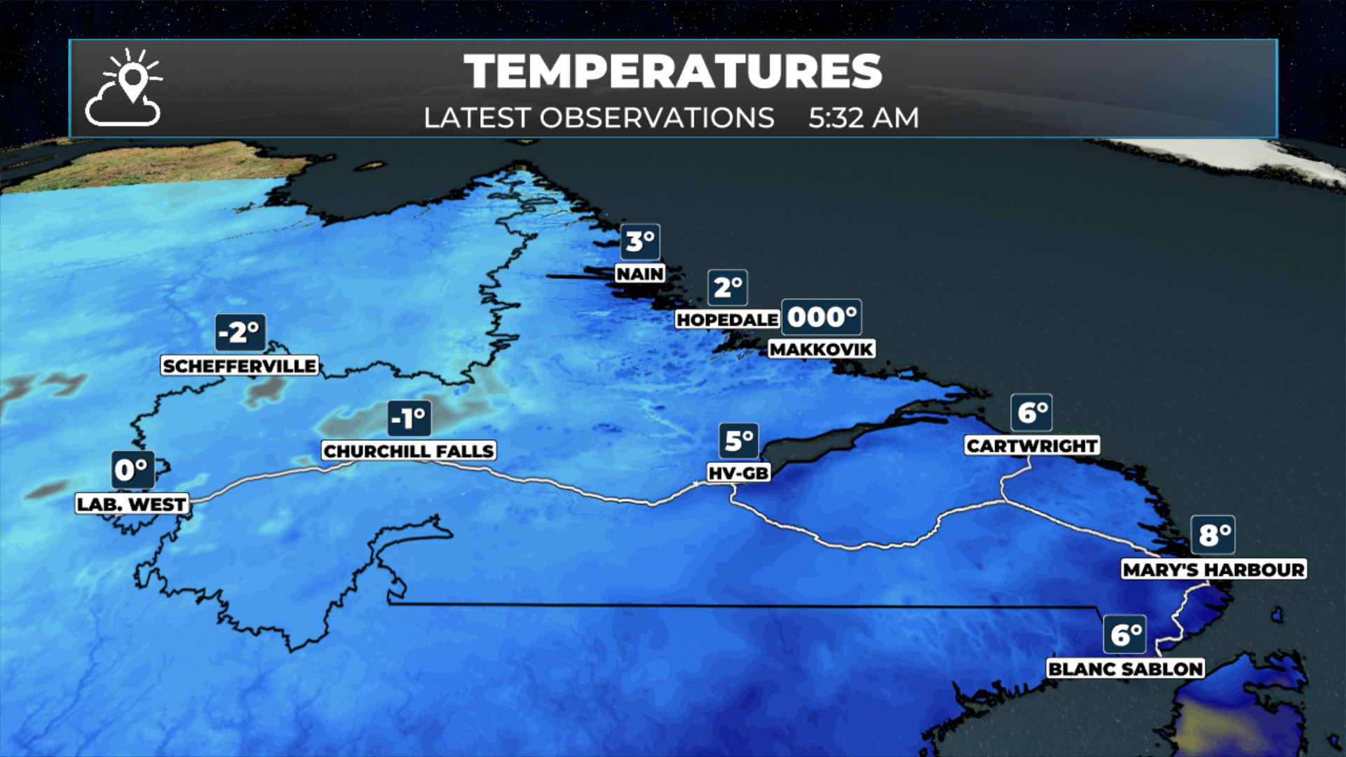
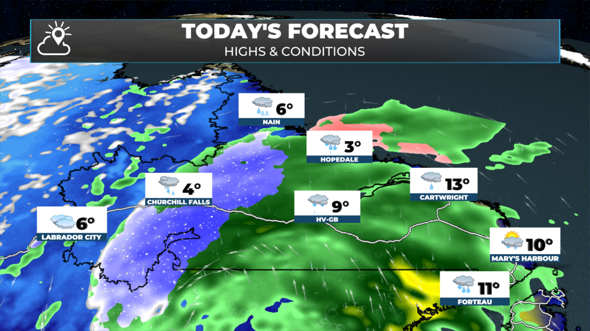
Temps are into the upper single digits to middle teens this morning!
Sunshine over the eastern half of Newfoundland this morning will give way to more clouds this afternoon. Southern areas will see an uptick in drizzle and fog throughout the day. Highs return to the middle teens, except cooler in onshore winds.
Central areas will see clouds increase today, with showers and/or rain likely by evening. Rain will arrive on the West Coast and GNP this afternoon. Highs will be in the mid-teens to single digits. There may be some wet snow in the Churchill Valley today.
Coastal and southeast Labrador will also see rain today. And it will be heavy at times. Labrador West will be cooler today. Highs reach the lower teens in the southeast to near 0ºC in the north and west. There will be areas of fog in the onshore, southerly flow.
Heavy rain is expected over parts of southwest Newfoundland and the Straits of Labrador, and Rainfall Warnings have been issued by Environment Canada. A Wreckhouse Wind Warning is also in effect for today, for gusts as high as 100 km/h from the southeast. Find all alert details here.
The animations below take you through what’s happening now, how the incoming rain plays out, and how much is expected to fall.
I’ll have a full forecast posted later today!
FIND ME ON SOCIAL!