
Thursday morning weather brief — September 4, 2025
Good Thursday morning!
We are starting the day with temperatures in the teens across the Island and teens and single digits throughout Labrador. The coolest readings in the Big Land are found on the mid and north coast. Here are the Provincial temps as of just after 6 AM NDT.
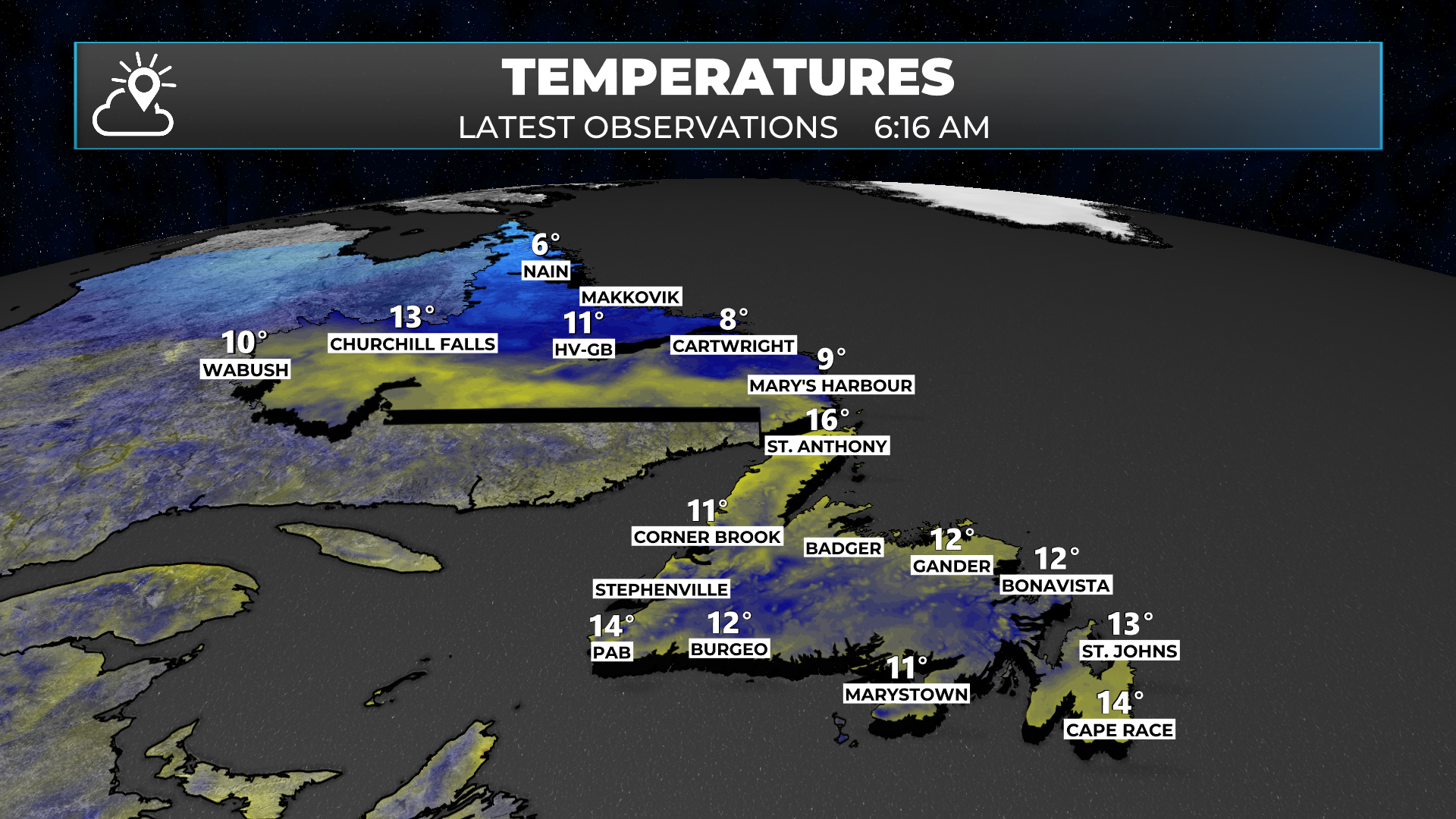
We are looking at widespread clouds and areas of rain and showers in Labrador, along with a warm/stationary front draped along the TLH. Meanwhile, there is a bit of drizzle and fog being reported in St. John’s, and many of the webcams along and near the south-facing shores are showing fog. Therefore, I can deduce that we are seeing areas of fog in the south!

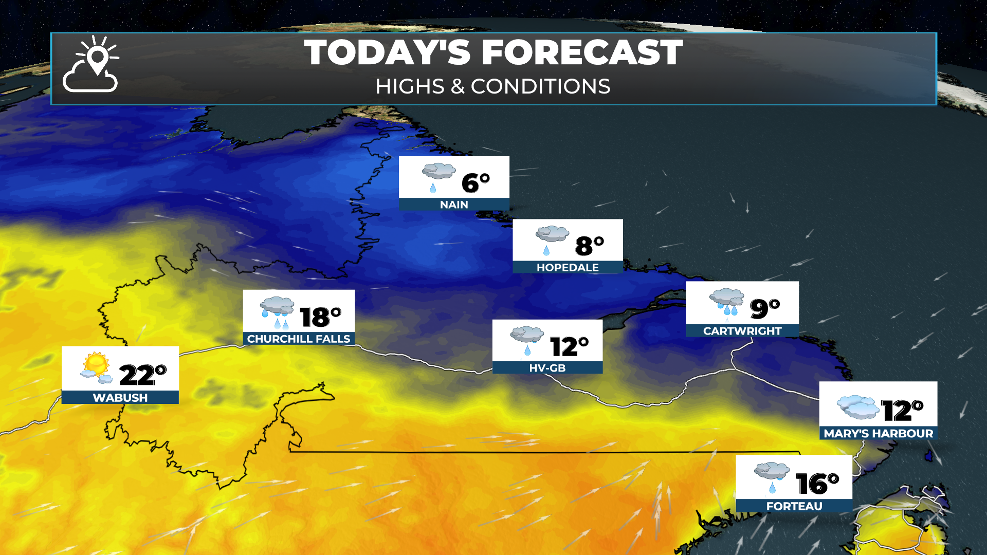
The simulated radar and (real) satellite imagery suggest we are seeing showers through much of the Labrador at this hour north of the front. Those showers will become a bit more widespread today and will drift toward the east. Highs will be cooler than the last couple of days, particularly in the west and near Happy Valley-Goose Bay.
This update is sponsored by Roebothan, McKay and Marshall.

Visit MakeTheCall.ca to learn about what the law firm can do for you!
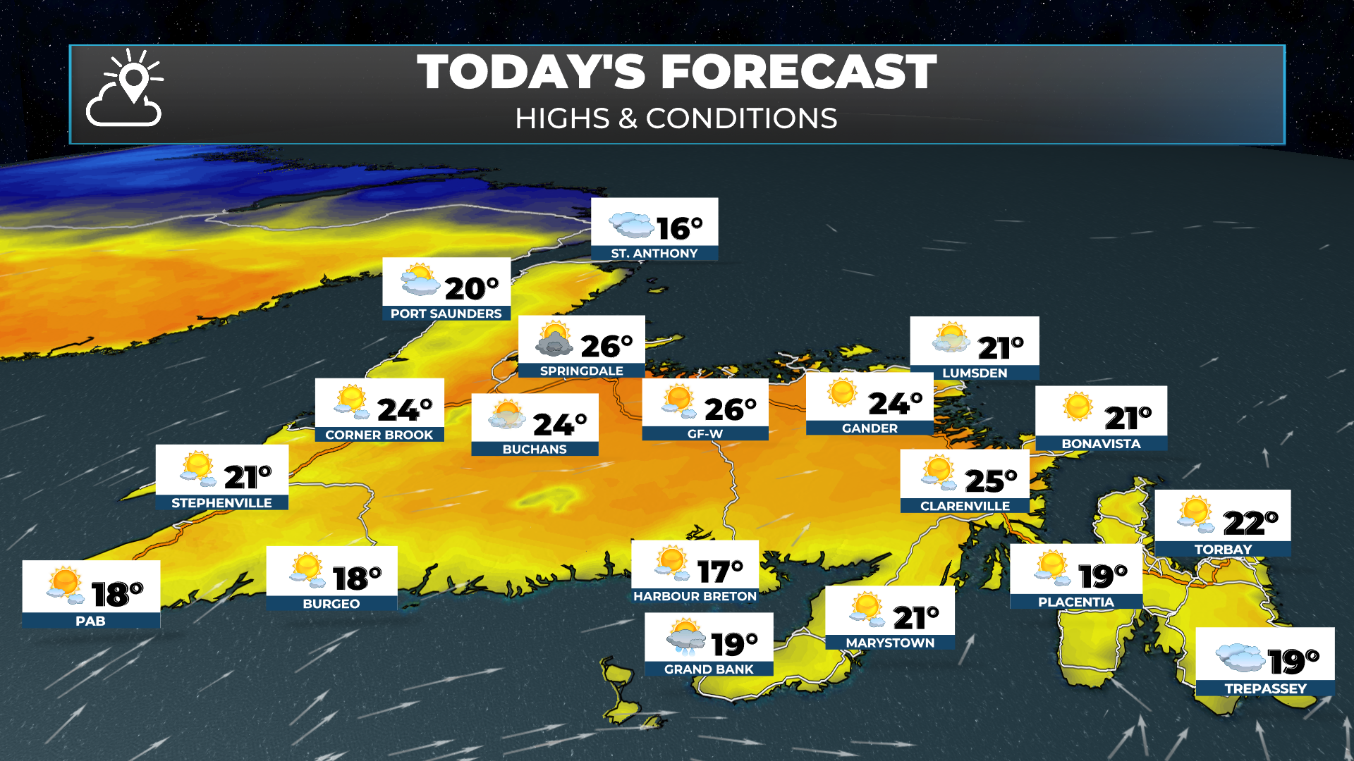
Meanwhile, the pockets of drizzle we are seeing on the Island will end this morning. The vast majority of Newfoundland will see sunshine today. Even areas seeing fog in the south should clear off today! There is a slight chance of an isolated shower or thundershower in Central today. And there will also be some showers later this afternoon on the Great Northern Peninsula.
The Look Ahead
Friday looks like a carbon copy of Thursday for Newfoundland
Labrador sees clouds and seasonable to abobe normal temps Friday, with shwoers arriving in the west late day
The humidity starts to increase on the Island Saturday which will keep the warm around, but make for foggy conditions along and near the South Coast and south-facing shores.
The weekend looks a bit unsettled in Labrador with lots of showers and possible thundestorms in the forecast
Showers and areas of rain may move onto the Island later Sunday
I’ll have the extended forecast posted later today. Be sure to GET THE SHEERR WEATHER APP if you haven’t already. And also don’t forget about the Map Room and the Road Cams!
Have a great Thursday!