
Thursday Morning Weather Brief | July 24, 2025
Good Thursday morning — It’s just before 6:30 AM!
We are waking up to comfortable temperatures in the teens across the Island and generally sunny skies. I cannot say the same for Labrador; while there may be sunny skies in some areas, we are seeing showers or rain in the east as we start the day. There are also likely a few showers in the west. Temperatures are mild, ranging from the middle to the upper teens for most areas. We can thank a warm front passing through for that.

The rest of the day in the Big Land will not be overly active, but some showers will roll back into western areas later this afternoon or evening. There may also be a few showers along the coast today as a weak trough (disturbance) moves from north to south. Temperatures are expected to climb into the lower 20s today.
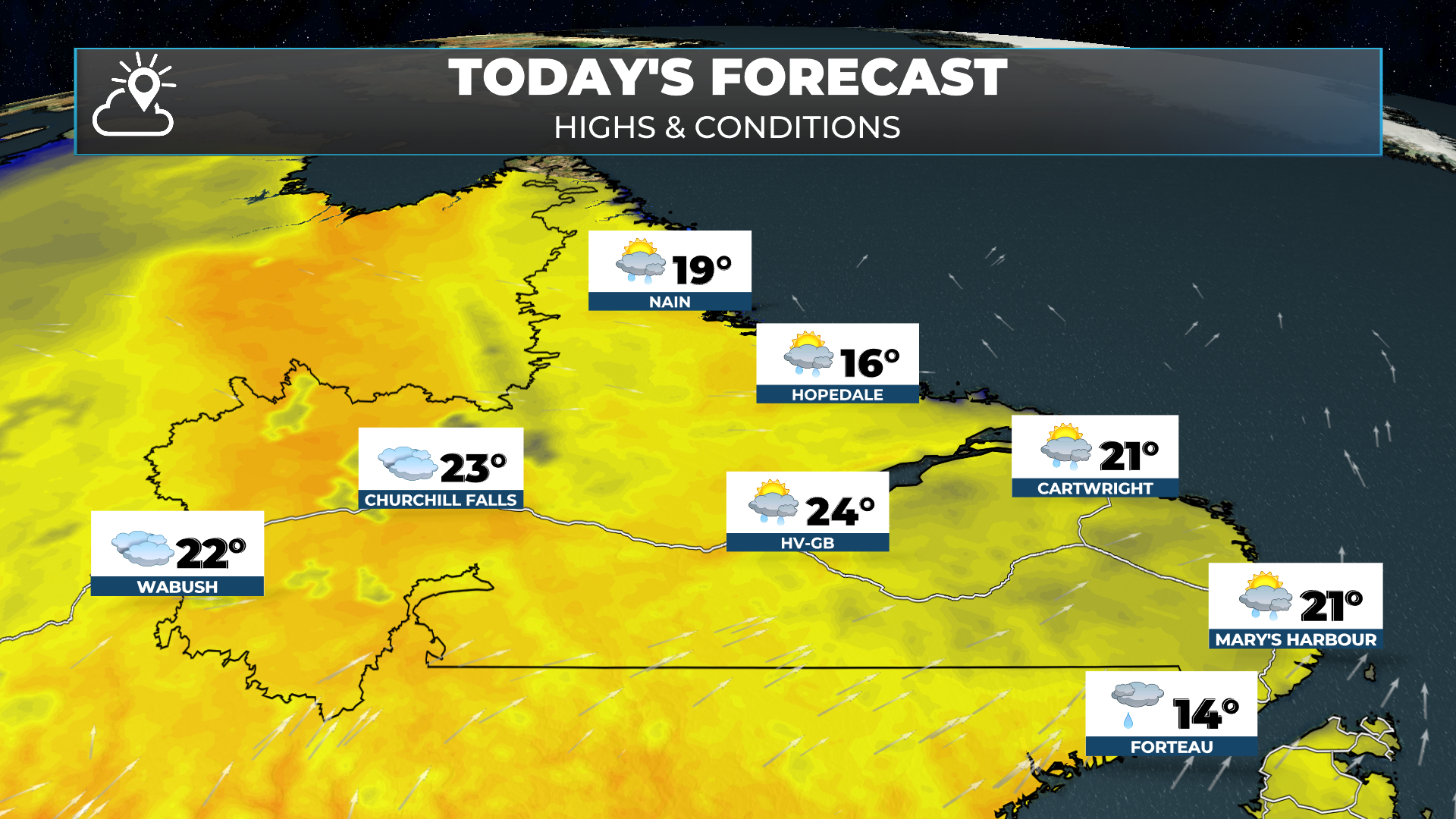
The Island will see a primarily sunny day to start with highs in the 20s. Clouds will increase for most areas in the afternoon, and showers will become numerous along and near the West Coast by evening. It will be breezy, with winds gusting as high as 40 to 50 km/h for many. The highest speeds will be along the western side of the Great Northern Peninsula, near the Strait of Belle Isle.

Showers will become a bit more widespread across the Island tonight, Friday, and more so Friday night and Saturday. In fact, it looks like some areas of eastern and northeastern Newfoundland will see some heavy rain Friday night into Saturday, including where the fires are burning. Initial forecasts suggest another 20+ mm is on the way for the Musgrave Harbour area.
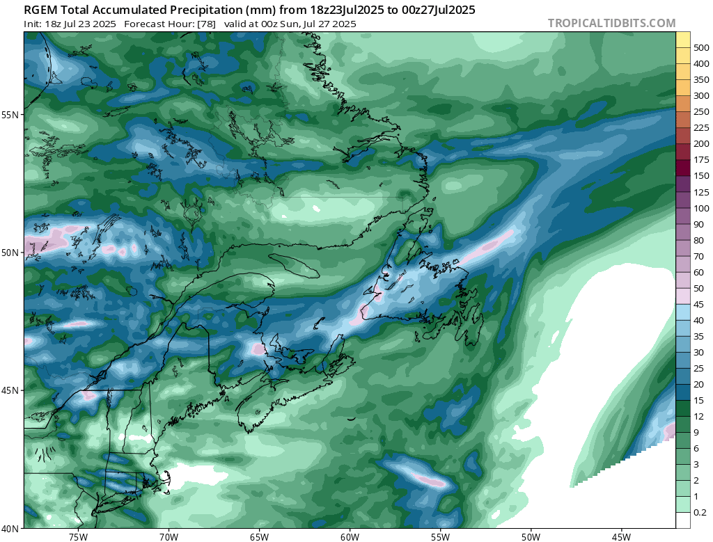
Rainfall totals over the next 84 hours - ending 9:30 PM Saturday evening (July 26, 2025).
More details on this will be provided later today in my full forecast.
Have a great day!
Eddie