
Monday Morning Weather Brief — September 29, 2025
Good Monday morning!
We are waking up to some showers across both eastern and western parts of the Island this morning. The radar at this early hour shows the showers are most numerous on the Avalon Peninsula. They will not stick around much longer, so by the time most of us are heading out the door to get to work or send the kiddos off to school, the rain should be ending or have ended.
This morning’s update is sponsored by Roebothan, McKay, and Marshall.

Visit MakeTheCall.ca to learn more about what the law firm can do for you.
There are also areas of rain and showers over much of western Newfoundland, the Great Northern Peninsula, and throughout much of the Big Land this morning. The showers in some of those areas will be a little more persistent today. Particularly on the GNP and into Labrador, where the rain and showers will linger through much of the day. Future Radar shows this very well.
Weather-wise, today we are looking at an area of low pressure and its attendant cold front moving through. This will set the stage for a cooler day compared to the weekend. Temperatures today will peak in the lower to middle teens on the Island. The exception will be the GNP, where highs will be more in line with what Labrador can expect — single digits.
Click to enlarge
It will also be a breezy day for much of the Island, but particularly for coastal areas. We are expecting sustained winds of 20 to 30 km/h, with gusts reaching 60 to 65 km/h in some areas. The wind speeds will drop by Tuesday morning for the Island, but will increase in some coastal areas of Labrador.
Tropical Update
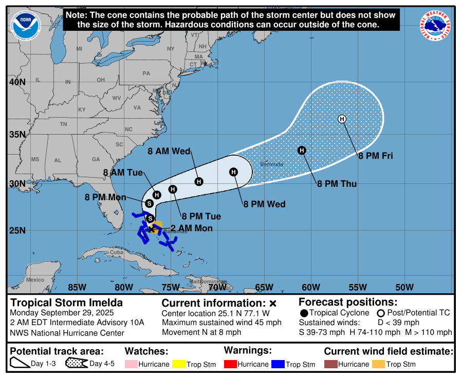
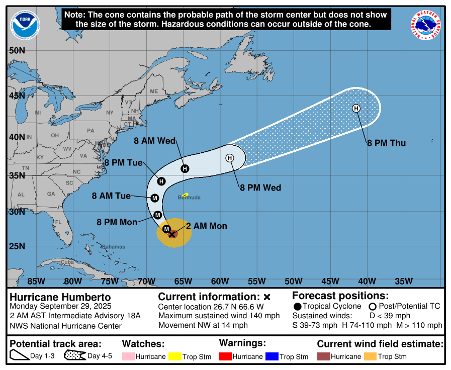
Hurricane Humberto and Tropical Storm Imelda are swirling in the Atlantic Basin this morning. Humberto blossomed into a Category 5 over the weekend packing winds of nearly 260 km/h. The storm is still a dangerous Category 4, with winds of 220 km/h as of early this morning. Imelda is also forecast to become a hurricane, with current forecasts indicating it will strengthen to a Category 1.

At this point, neither storm should play a direct role in the weather over Atlantic Canada, as both are going to stay well south of the region. Tropical Storm Imelda will impact the weather on the east coast of Florida, the Bahamas, and the southeastern United States over the next couple of days. If you’re traveling to those areas, particularly near the coast, be sure to listen to local weather reports to find out what to expect. That being said, Imelda is forecast to turn away from land before getting overly close, which means any impacts will be relatively minimal.
I’ll have my next update posted this afternoon! Have a great Monday!