
Friday Morning Weather Brief — November 21, 2025
Good Friday Morning!
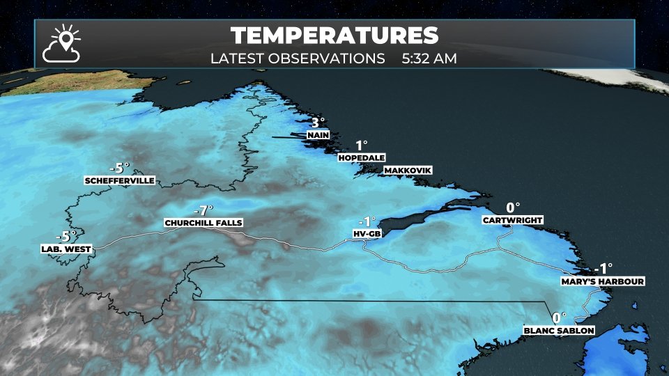
As of just before 6 AM NST, some areas of the Province are quite chilly this morning. In fact, the two coldest spots appear to be Badger and Churchill Falls, which reported temperatures of -7º. There are plenty of other areas near the freezing mark, but few places are as cold as those to start the day.


We will see temperatures rebound reasonably well for many areas by the afternoon. Weather-wise, we will start the day quietly, but that will not last. Light snow will spread into Labrador West this afternoon, and rain will push into southern areas of the Island by late afternoon, followed by central and western areas by 8 PM. Areas north of the South Coast may see snow at first, which will quickly change to rain. The exception will the GNP tonight, where most areas will remain snow.
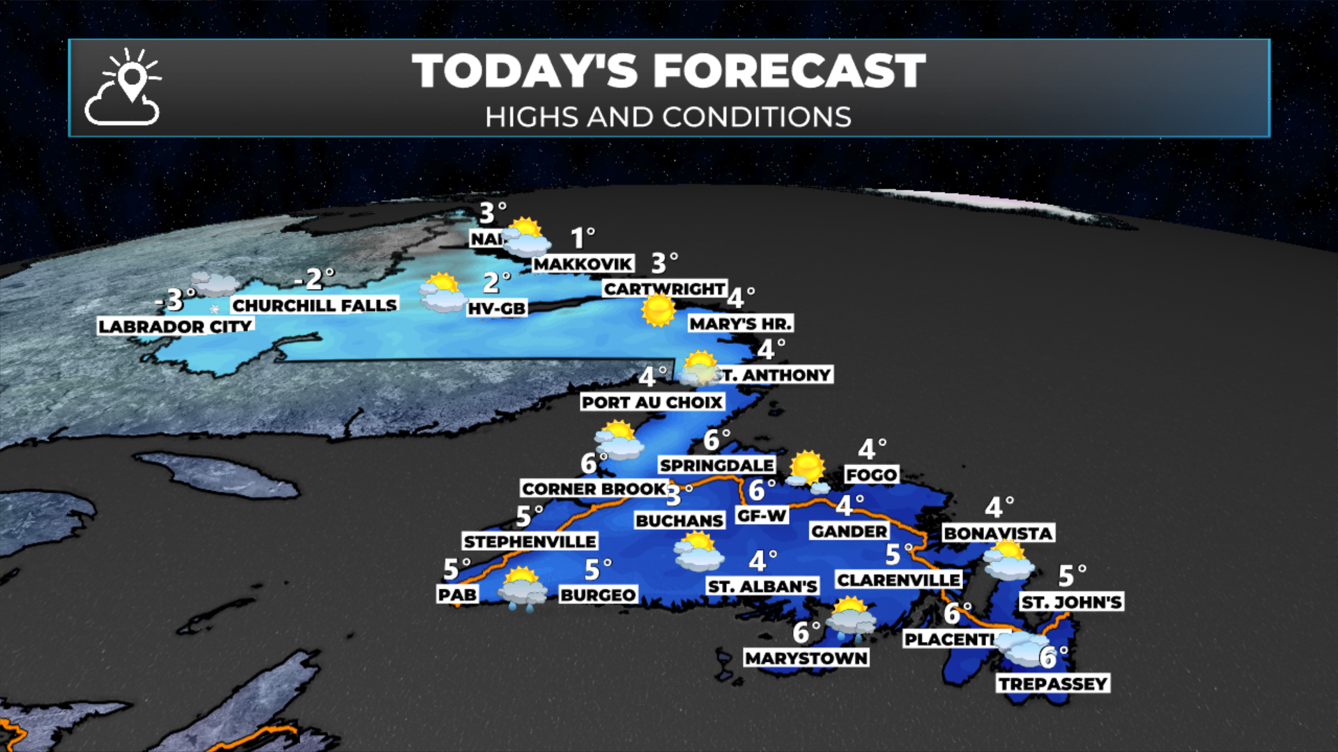
If you’re taking a trip across the Big Land or the Island today, the weather shouldn’t play much of a role until evening. Most of today looks quite decent across Newfoundland and Labrador. Saturday, on the other hand, looks a bit wintry in Labrador and rainy on the Island.

This morning’s update is sponsored by Roebothan, McKay, Marshall.
MakeTheCall.ca
Saturday will see morning rain and afternoon showers over most of Newfoundland, while light snowfall continues over much of Labrador. Rainfall amounts between tonight and late Saturday across Newfoundland will range from 5 to 15 mm, while roughly 5 to 10 cm of snow will fall in Labrador and the Great Northern Peninsula of Newfoundland. Higher amounts are possible locally for both rain and snow.
Another area of low pressure will move through Saturday night, passing over the Avalon Peninsula. There should be enough cold air on the west side of a swath of Newfoundland that will see some snow. Near and east of the low’s track, rain will fall, and it will be heavy at times. Snowfall amounts will be less than 10 cm, but it’s notable as it could impact travel in parts of central and the Bay d’Epsoir Highway Sunday morning.
I’ll have more details on the weekend forecast later today.
Stay tuned!
I’ll have my next update posted later today!
📱 Get the Sheerr Weather App in the Apple App Store and Google Play Store.
🗺️ Check out the Map Room to see all the latest weather observations for the Province.
🎥 Check out the Provincial Highway Cams to see 👀 what’s going on around our highways and byways!