
Wednesday Morning’s Weather Briefing — August 19, 2026
Good Wednesday morning!
We are waking up to areas of showers and rain across much of Newfoundland this morning. The radar loop above shows that well.
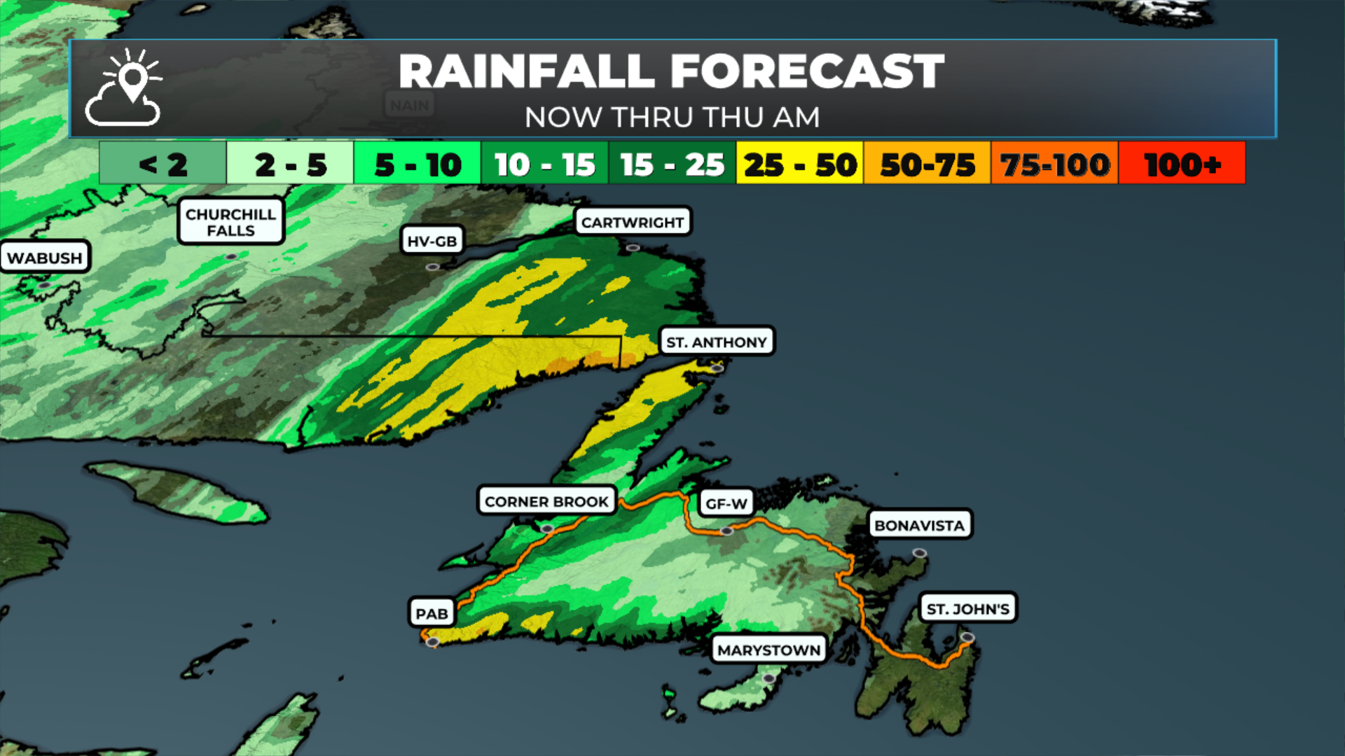
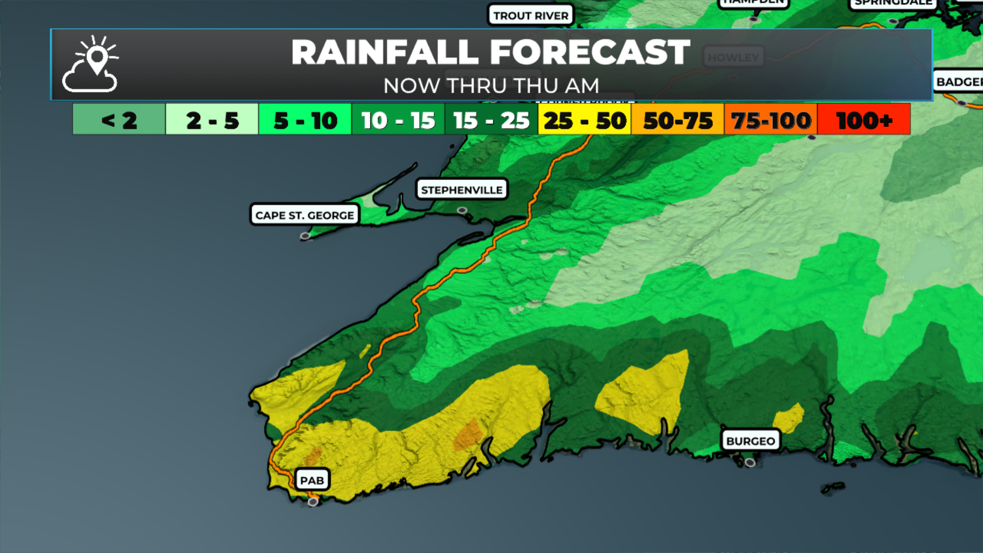
A Rainfall Warning and a Wreckhouse Wind Warning (Yellow Level) are currently in effect for the Channel-Port aux Basques area.
Rain, showers, and even thunderstorms should become more widespread over the western third of Newfoundland today, while the eastern two-thirds will see less activity.
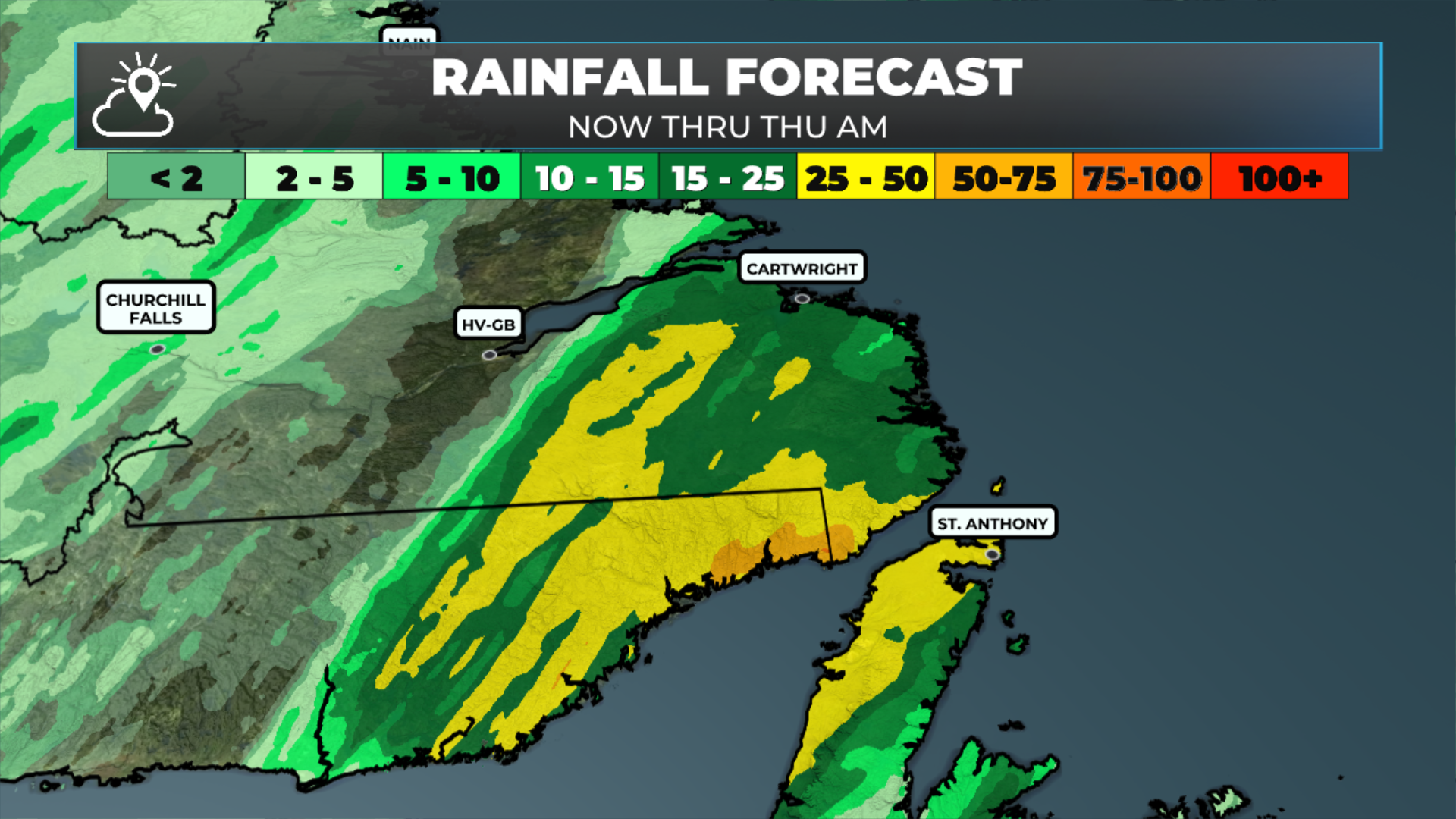
Rain becomes widespread in southeast Labrador later today.
The air will become more muggy over Newfoundland between today and Thursday.
This morning’s update is sponsored by Roebothan, McKay, Marshall.

Visit MakeTheCall.ca today to learn more about how the law firm can help you!
Today’s Forecast — Newfoundland
Showers and rain will be most numerous across the southern and western parts of the Island, including the Northern Peninsula, as an area of low pressure spins near Nova Scotia. Some of the rain will be locally heavy, especially in the southwest, where rainfall amounts may exceed 60 mm by late today or early Thursday.
Central and eastern areas will see scattered showers this morning, becoming less widespread through the day. However, the chance of showers will remain in the forecast, even as skies turn partly cloudy to mostly sunny once this morning’s showers move through. Highs will reach the upper teens to mid-20s today.
There will be a substantial difference between coastal and inland temperatures today, even in the Metro area. Locations along or near the East Coast will reach the upper teens, while inland areas and CBS will climb into the lower to mid-20s.
Today’s Forecast - Labrador
A mix of sun and cloud this morning will give way to more clouds than sun by afternoon for most of Labrador. The exception will be along the middle and north coast! Rain will spread into the southeast later today, and this afternoon will see showers and thunderstorms move into the west. Some of the storms that move through will be strong and have the potential to produce gusty winds, small hail, heavy rainfall, and (obviously) frequent thunder and lightning. Highs reach the lower to mid-20s.
My next update will be posted later today!
FIND ME ON SOCIAL!
