
Tuesday Morning’s Forecast — June 30, 2026
Good Tuesday Morning
A dry start to the day will be common across the Province, with areas of low cloud, drizzle and fog.
Fog retreats to the coast today, particularly along and near south-facing shores of the Island and skies will turn partly cloudy to mostly sunny. Highs reach the teens to the mid-20s today across the Province.
Numerous showers and thunderstorms will develop over Newfoundland this afternoon, potentially even on the Avalon. Some of the storms will be strong and produce locally heavy rainfall, gusty winds, small hail and frequent thunder and lightning. Similar to yesterday.
Scattered showers and thunderstorms will develop across much of Labrador this afternoon, and the stronger ones will produce the same types of elements expected on the Island.
This morning’s update is sponsored by Roebothan, McKay, Marshall.

Visit MakeTheCall.ca today to learn more about how the law firm can help you!
Newfoundland’s Forecast
Fog will retreat to coastal areas this morning, particularly along south-facing shores. High temperatures climb into the teens to mid-twenties today, with the coolest conditions in onshore westerly to southwesterly winds. Wind speeds will generally be light today.
Afternoon showers and thunderstorms will develop across most of Newfoundland, hitting interior, central, and northeastern areas first before drifting south. There will be even some storms on the Acvalon (or so I think). Some storms will be strong with widespread coverage expected this afternoon. The main threats are frequent thunder and lightning, wind gusts potentially exceeding seventy kilometres per hour, brief heavy rain, and small hail — similar to yesterday's activity but with more extensive coverage anticipated.
Due to atmospheric instability, significant lightning is expected as these storms develop this afternoon. Remember: when you can hear thunder, lightning is present and dangerous. When thunder roars, go indoors.
Labrador’s Forecast
Generally sunny skies are expected across most of the area today with scattered afternoon showers and thunderstorms. The storms will be focused more inland from the coast and in the southeast, with less activity over western, interior, and central areas.
Temperatures will peak near twenty degrees on the coast, climbing close to the upper twenties around Happy Valley-Goose Bay, and reaching the lower twenties back in the west.
Wildfire Update / Smoke
A new wildfire has been reported in interior Newfoundland by the province, called the Crippleback Creek Fire. It is currently three hectares in size and listed as out of control on the province's wildfire dashboard. That is the only fire listed in Newfoundland currently.
Many fires are burning in Labrador. Most are not threatening communities, except the fire burning near Walsh River in Labrador West, which has caused the town of Labrador City to issue a state of emergency. A new wildfire has also been reported in interior Newfoundland called the Crippleback Fire—currently three hectares in size and listed as out of control on the province wildfire dashboard. That's the only fire listed in Newfoundland currently. As more information becomes available, I will post updates on my social feeds throughout the day.
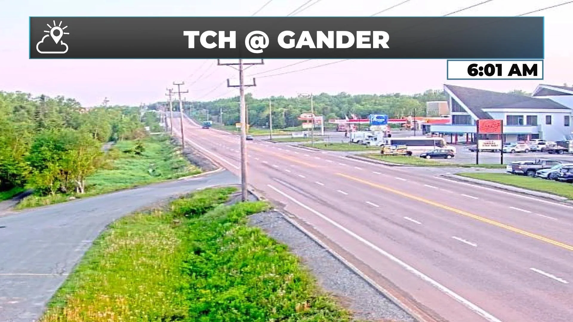
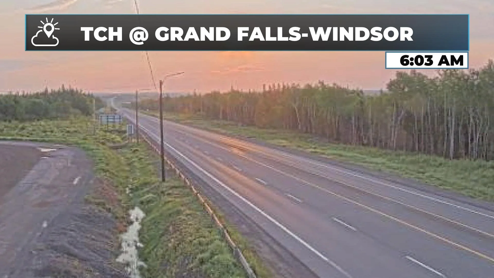
Smoke from numerous wildfires burning in Labrador and parts of Quebec may be spotted across much of the province today. The best way to notice it is by observing very red sunrises or sunsets, or a red sun during the day. This happens because smoke makes it harder for the sun's wavelengths to reach the atmosphere, and red—being a long wavelength—is what we see most when smoke is overhead. This is what I observed on the webcams in Gander and Grand Falls-Windsor this morning.
It may impact air quality locally, though reports haven't come in yet; I'll be keeping an eye on that. With warm temperatures and relatively dry air in place, I do expect fire activity to flare up this afternoon in Labrador, and I'll be watching that closely as well.
My next update will be posted later today!
FIND ME ON SOCIAL!