
Thursday Morning’s Weather Briefing — March 5, 2026
Good Thursday Morning!
Here are today’s weather highlights:
Any standing water has frozen solid overnight, except VERY slick conditions on untreated surfaces in areas that saw snow and rain yesterday.
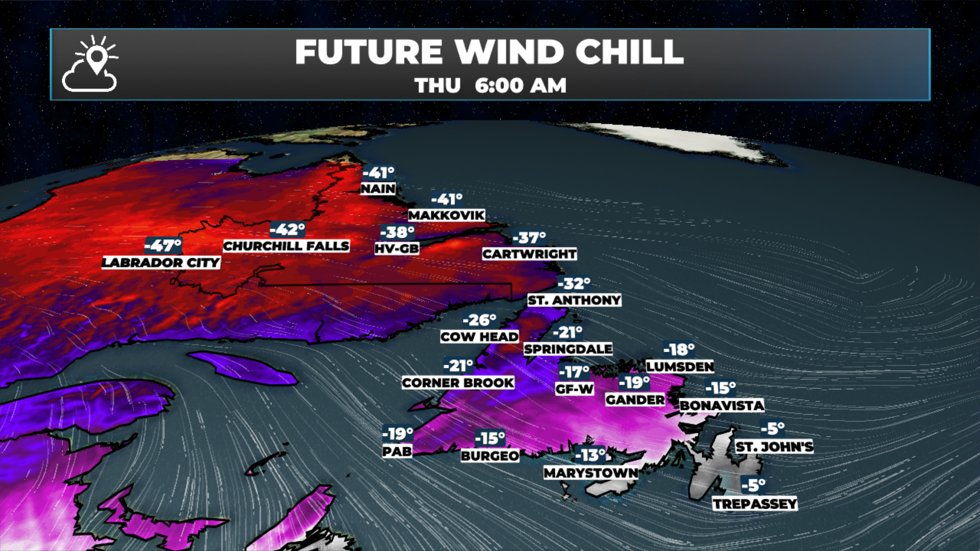
Arctic air is settling across the Province this morning — wind chills will be in the minus 20s to nearly -50ºC across NL at times today. Yellow Level Extreme Cold Warnings are in effect for the Great Northern Peninsula and all of Labrador’s alert areas.
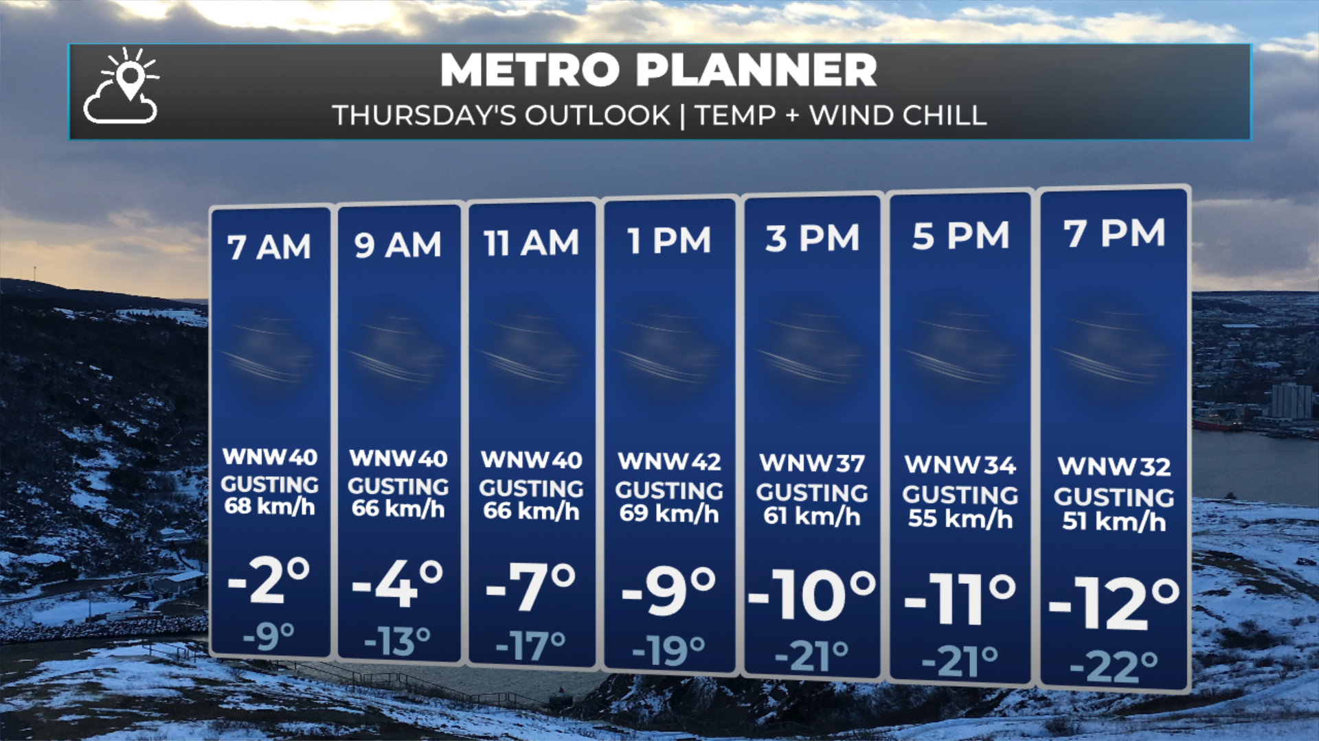
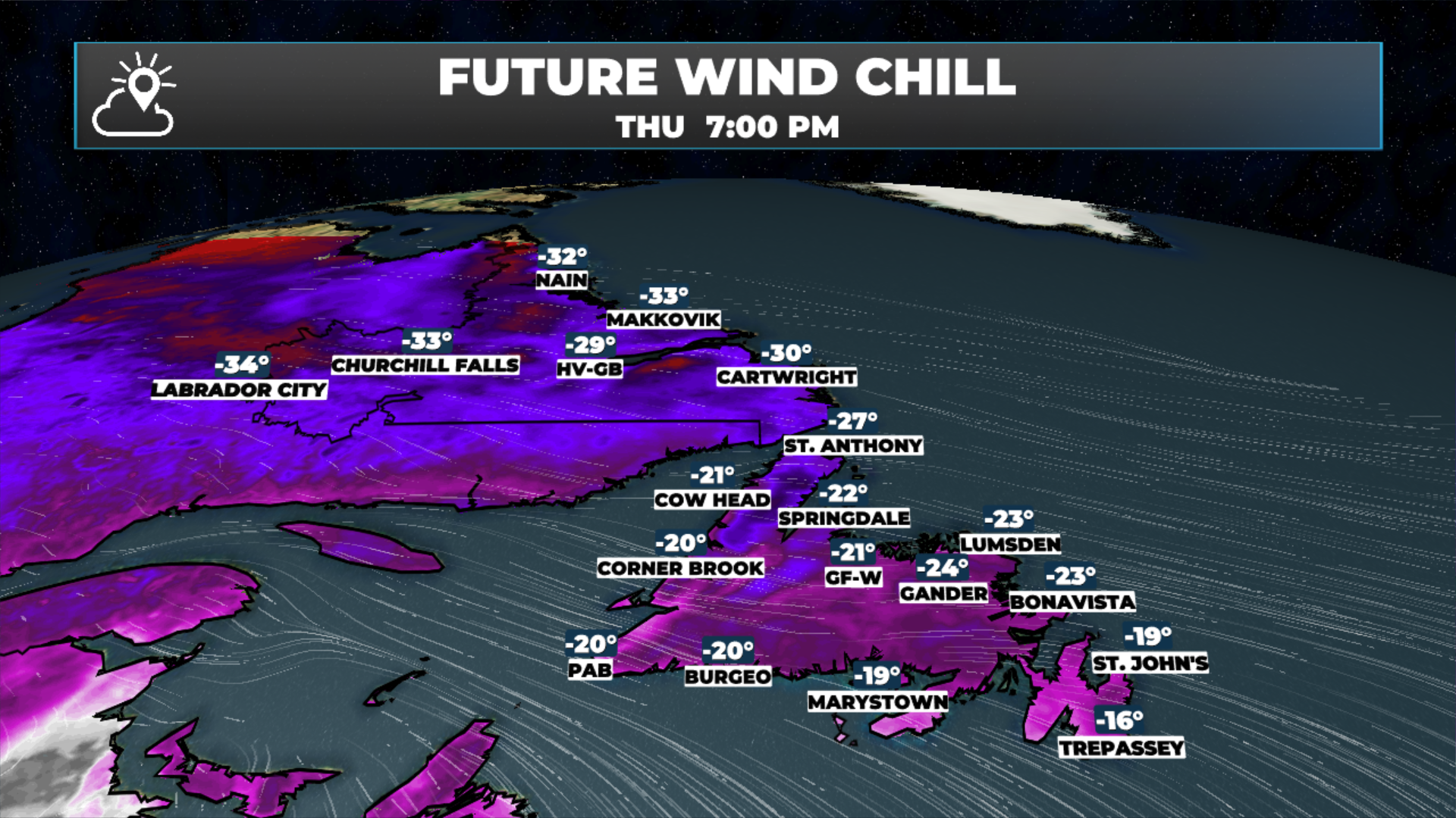
Temperatures in eastern Newfoundland are quite “mild” this morning, but readings will fall from near 0ºC to -10ºC through the day, with wind chills falling into the minus 20s. Areas to the west will see these conditions, or colder, throughout the day.
Some flurries and or a brief snow squall will be around eastern areas very early this morning — that’s the cold front moving through.
Other than being cold and windy, expect a mix of sun and cloud across most of NL today and tomorrow. The next round of snow moves into Labrador on Saturday. While the Island will see rain and a significant warmup on Sunday.
The Forecast
Arctic will settle across the Province today, bringing one of the coldest days of the winter. Temperatures for most areas will be in the minus teens, or less, today with wind chills into the minus 20s or lower. Wind chills on the Great Northern Peninsula and throughout much of Labrador will be in the -30ºC to -50ºC range this morning. While the chill factor will not be as low later today, it will still be quite cold. Yellow Level Extreme Cold Warnings are in effect through the morning.
Extreme Cold Warning goes into effect tonight and continues into Thursday (March 4 and 5, 2026)
The images below show how the wind chills will play out across the Province today. Note how in the east, the wind chill is quite mild this morning, but it’s a different story by the afternoon. The cold air will move into this area throughout the day, leading to falling temperatures. In the Metro, as an example, temperatures will fall from near 0ºC this morning to -10º by late afternoon. Wind chills will dip into the minus 20s.


Outside of the cold, the weather today will be on teh quiet side across the Province. Tomorow looks simlair. The next round of weather arrives over the weekend and that will be more snow in Labraor and the potential for a thaw on the Island. Details on that later!
FIND ME ON SOCIAL!