
Thursday Morning’s Weather Briefing — August 20, 2026
Good Thursday
An area of heavy rain and embedded thunderstorms will move across the Avalon Peninsula over the next few hours.
The muggy air is starting to take hold across the Island; dew points are creeping into the mid-to-upper teens.
Highs reach the lower to mid 20s and even the upper 20s across Newfoundland today, with humidex values reaching the 30s.
Areas of showers and possible thunderstorms will linger over eastern Newfoundland through much of the day.
Afternoon showers and thunderstorms will pop up over southeast Labrador, and some could be intense. Most of these will be over remote areas.
Highs in the Big Land reach the teens in the west and generally 20s elsewhere.
This morning’s update is sponsored by Roebothan, McKay, Marshall.

Visit MakeTheCall.ca today to learn more about how the law firm can help you!
Today’s Forecast — Newfoundland
Showers and thunderstorms this morning over eastern Newfoundland will give way to more showers and isolated storms in the same area this afternoon. Central and western areas, along with the Northern Peninsula, will be dry today. There will be some dense areas of fog along and near the southern-facing shores of the Island today. The humidity is up, as we are getting a moisture fetch originating in the tropics today. The animation below illustrates that well!
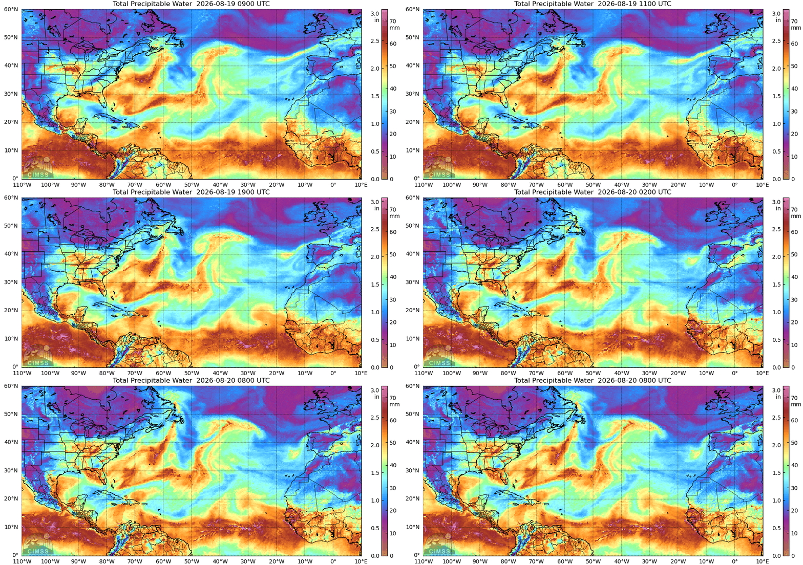
The bulk of the moisture today will be directed toward the eastern half to one-third of the Island. That means the sun will shine over the central and western areas, while clouds and showers linger in the east. The fog remains entrenched along and near the southern-facing shores but may start to clear along the western edge of the South Coast late in the day. Temperatures this morning are generally in the teens across most of Newfoundland and will only climb from there.
Temperatures across Newfoundland observed at 6:35 AM NDT on August 20, 2026.
Highs reach the lower to middle 20s over eastern Newfoundland and the GNP, and the middle to upper 20s in central and western Newfoundland. Southern areas will see highs closer to 20ºC. Humidex values reach the mid-20s to low 30s this afternoon. The highest values will be observed in the areas with the warmest temperatures this afternoon.
Newfoundland's forecast for today - August 20, 2026.
Today’s Forecast - Labrador
Mostly sunny skies this morning across the region give way to a mix of sun and cloud by the afternoon. Highs reach the teens to mid-20s. There will be some pop-up showers and thunderstorms that develop in the southeast, between Goose Bay and the southern border with Quebec. Those will head toward the northeast, arriving on the coast between Mary’s Harbor and Rigolet this evening. Some of the storms will be strong, but the strongest will be in remote areas. The developing storms have the potential to produce gusty winds (up to 70 km/h), small hail, heavy rainfall, and frequent thunder and lightning.
Labrador's forecast today - August 20, 2026
Today's thunderstorm risk and hazards. Source: Env. and Climate Change Canada.
This animation of future radar and satellite should give you a pretty good idea of how the weather will play out across the Province today.
Don’t forget to check out the links below to track the showers yourself. The best place for that is in the app via the LIVE radar page!
My next update will be posted later today!
FIND ME ON SOCIAL!
