
Thursday Morning Update — January 29, 2026
NL's forecast for today, January 29, 2026
Good Thursday morning!
Here are today’s weather highlights:
It’s windy… again. Mainly on the Avalon, and gusts will be as high as 80+ km/h this morning. They will slowly ease through the day.
It is snowing over much of the Island this morning, according to radar imagery. Locally, it’s very stormy. A good bit of southeast Labrador is also seeing snow this morning, especially in the southeast.
An intense snow squall is located on the Southern Avalon and likely extends on the Burin Peninsula. That should get pushed south, but areas under are seeing very snowy and stormy conditions. Locally, blizzard-like, I would think.
Conditions over most areas should improve, slowly, through the day, but areas of the Northern Peninsula and coastal Labrador will only be in for a break as more snow develops this afternoon (if it stops).
Active weather like this continues into Friday, although it becomes more focused on coastal Labrador and the West Coast.
RADAR + SIMULATED RADAR IMAGERY - 6 AM
Radar imagery as of about 6 AM shows areas of snow across much of the Island this morning from the West Coast, through central and even onto the Avalon. That area of snow is drifting from north to south and is farther south than guidance indicates it should be. It’ll be interesting to watch this today… There is also a snow squall that extends from the Southern Shore westward across the Placentia Bay onto the Burin Peninsula. And while this is drifting south, it’s not doing so quickly. Areas under this are seeing very stormy conditions, even blizzard-like, due to falling and blowing snow. Simulated radar imagery shows where it’s likely snowing, which covers a much larger area than the Doppler radar on both coasts can show. Much of the Province is seeing snow this morning. Expect a slow drive for your morning commute in some areas.
Today’s Forecast
Newfoundland
Snow will fall over western areas, the Northern Peninsula, Central and parts of the northeast coast. The flurries, squalls, and pockets of light snow we are seeing over the Avalon and Burin Peninsulas should ease later this morning. The same should hold true for the Bonavista Peninsula. The high winds (gusts near 80 km/h) we are seeing in the east will also ease this morning, but it will remain breezy. In fact, most of the Island will be breezy today. High temperatures reach the single digits, and may near the freezing mark on the tip of the Northern Peninsula, while some maritime air moves in.
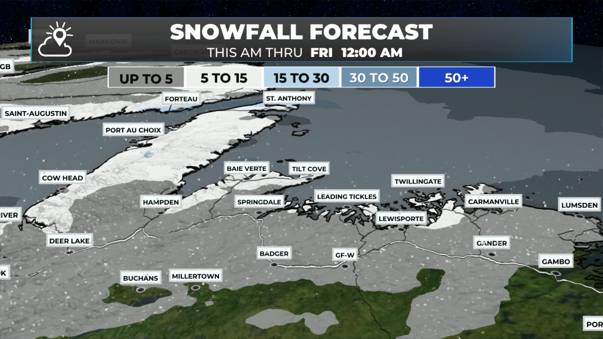
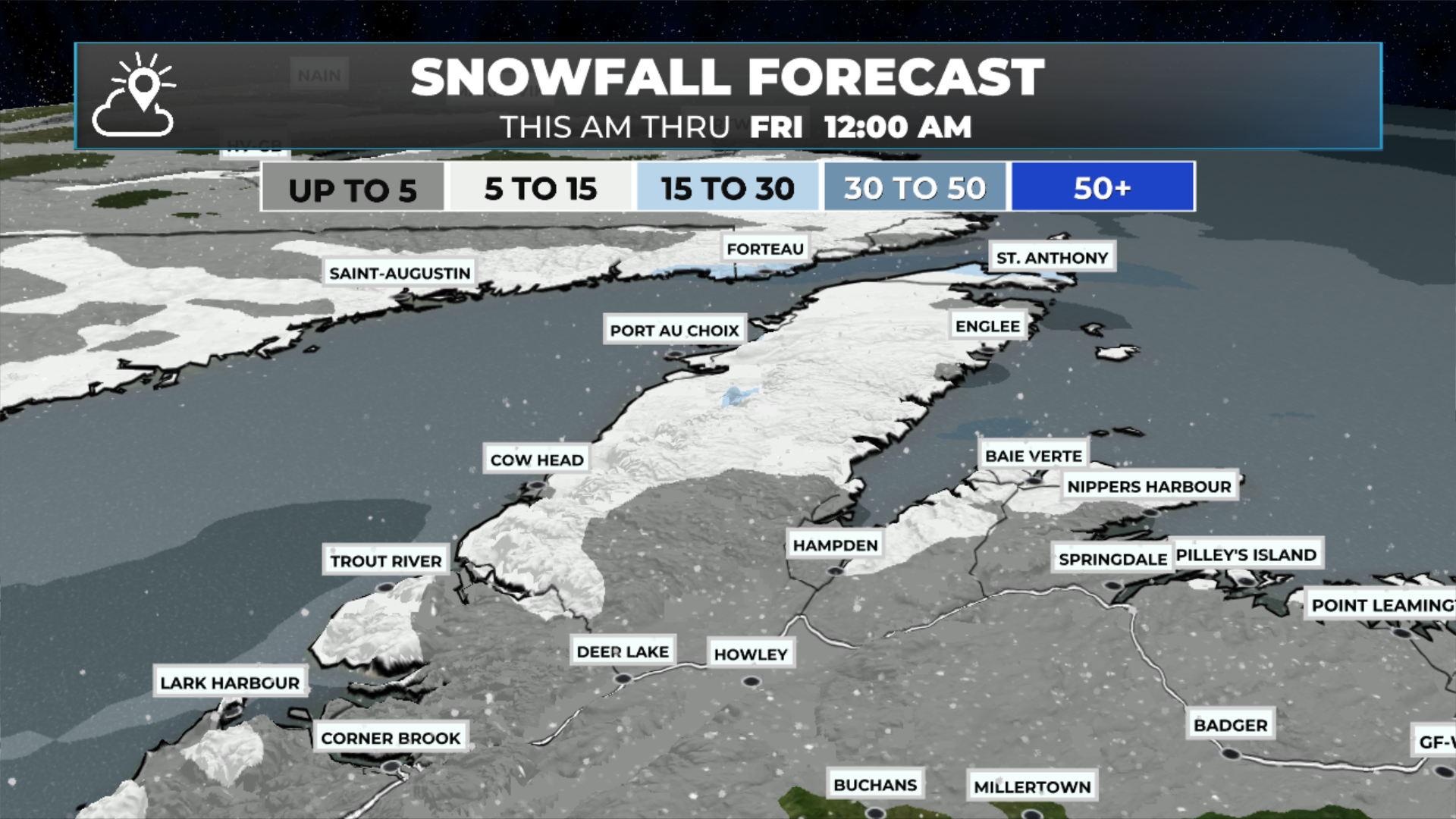
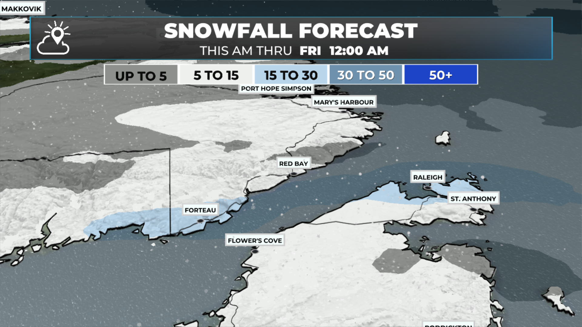
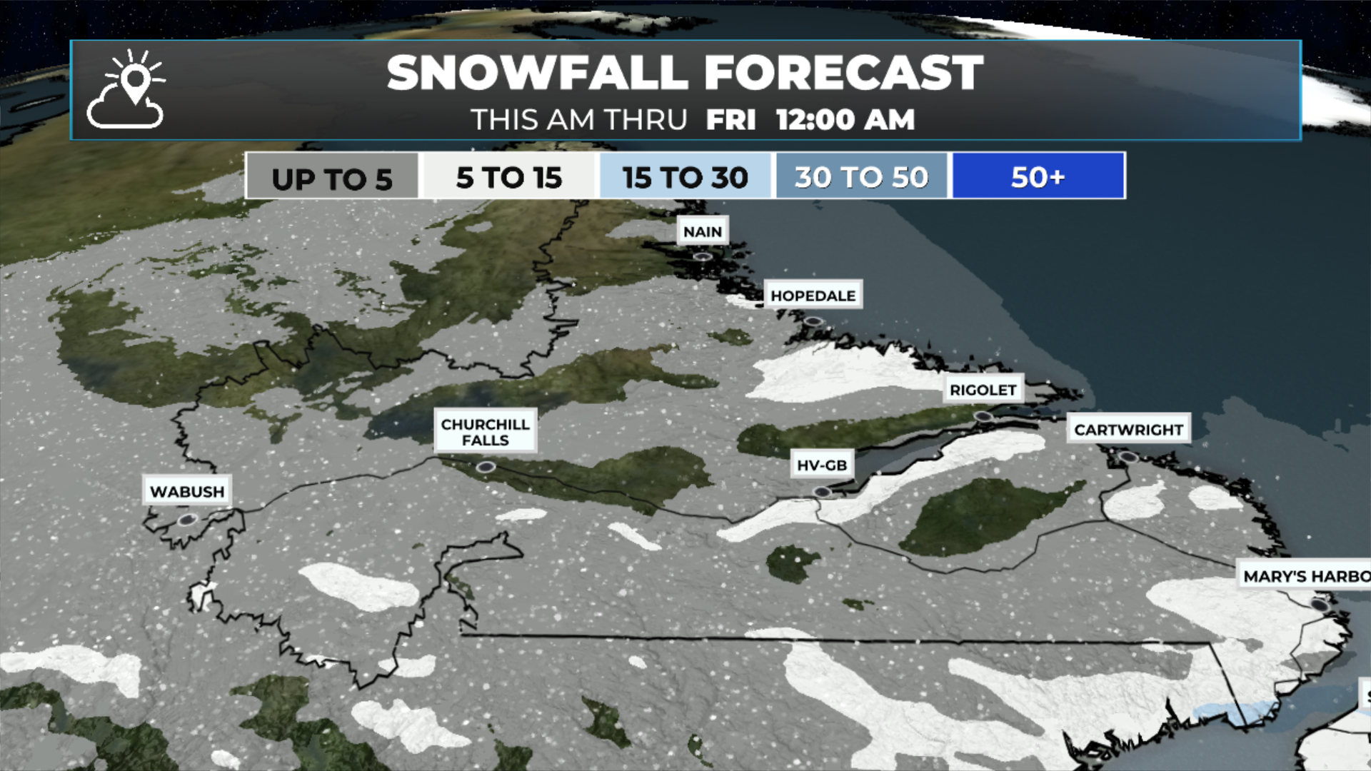
Snowfall forecast ‘gallery’ — tap each image to enlarge.
Labrador
Periods of snow will continue along the coast today, heavy at times this morning in the south and near the Straits. The snow will ease later today, but another round of moderate to heavy snowfall will move in overnight. The flurries and pockets of light snow seen in the west and inteiror areas this morning will also end by early afternoon. Highs range from near 0ºC on the coast to -10º in the west.
Future radar (below) should give you a good idea of how the day will play out. You can also view something like this for yourself in the app!
A potent winter storm looms for early next week… I’ll have my opinion on that and a full forecast for you posted later today. Meanwhile, don’t forget to check out the links below!
📱 Get the Sheerr Weather App in the Apple App Store and Google Play Store.
🗺️ Check out the Map Room to see all the latest weather observations for the Province.
🎥 Check out the Provincial Highway Cams to see 👀 what’s going on around our highways and
FIND ME ON SOCIAL!