
Patchy frost expected across parts of Newfoundland early Sunday
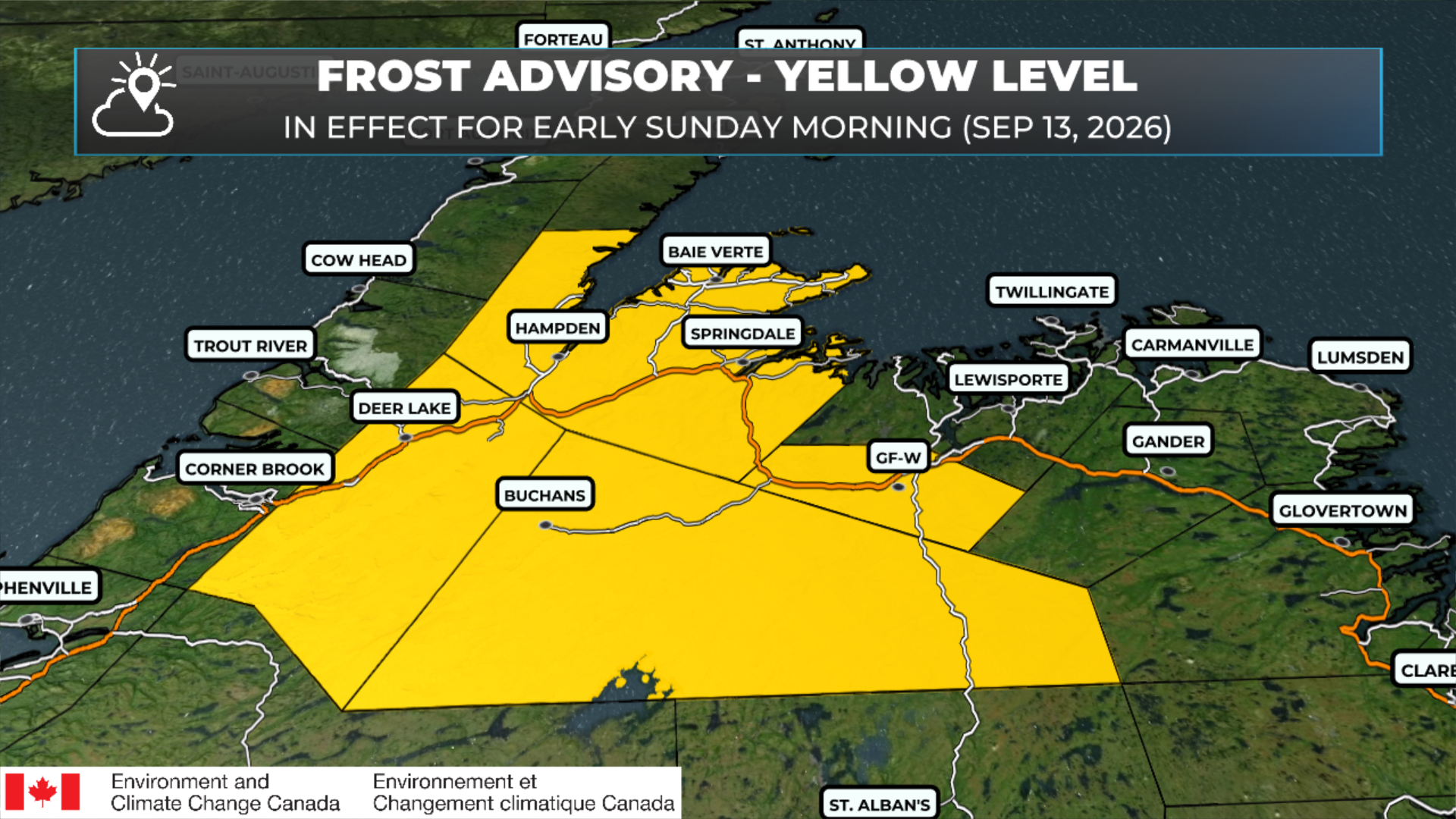
Frost Advisory in effect for parts of central and western Newfoundland for Sunday morning (September 13, 2026).
If you have sensitive plants outside, tonight is a good time to cover them or bring them indoors.
Environment Canada has issued a Yellow-Level Frost Advisory for parts of western and central Newfoundland, with patchy frost expected early Sunday morning, September 13.
The advisory covers:
Deer Lake – Humber Valley
Buchans and the interior
Grand Falls-Windsor and vicinity
Green Bay – White Bay
Temperatures are forecast to fall to between 2°C and 6°C, with the lowest readings in low-lying areas. Clear skies and light winds will allow conditions to cool enough for patchy frost to develop, particularly in sheltered spots.
Even with forecast air temperatures above freezing, temperatures at ground level can be colder, allowing frost to form.
Environment Canada lists forecast confidence as high, with a moderate impact level. Damage to plants, trees, and crops is possible. Also keep in mind that frost is possible outside of the warned area as well, but it looks to be more isolated in nature. The map below shows where temperatures will be cool enough that patchy frost is possible.
Take a few minutes this evening to protect anything sensitive to frost, especially if you live in a low-lying area within the advisory zone.
Pockets of frost are possible in the areas outlined in blue, where lows be less than 5ºC, but above freezing.
