
Monday Morning’s Weather Briefing - February 16, 2026
NL’s forecast for today — February 16, 2026
Good Monday Morning!
Here are today’s weather highlights:
A developing low will pass south of the Avalon Peninsula today, and the majority of its snow will remain offshore. Some light snow and flurries will fly at times today over the southern Avalon, the southern shore and possibly the Metro area. Snowfall amounts will be less than 2 cm.
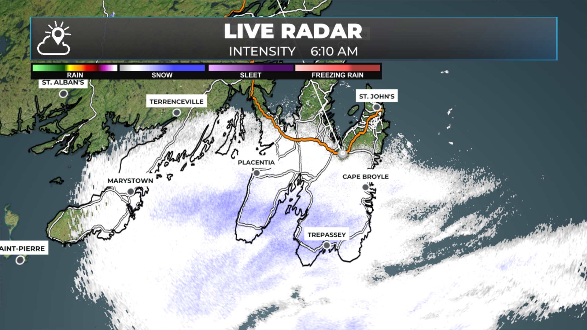
Morning radar image shows the light snowfall over parts of the southern and eastern Avalon Peninsula early this morning.
High pressure builds over the region today, and aside from scattered flurries, the weather looks quiet, mostly cloudy to cloudy.
Temperatures peak near 0ºC on the Island and minus single digits in Labrador
Tuesday will also be fairly quiet — the next winter storm rolls into eastern areas Tuesday night.
A significant winter storm will bring heavy snowfall to much of the Avalon Peninsula and parts of northeast Newfoundland from Tuesday night into Thursday morning. While wind speeds will not be extreme, gusts of up to 80 to 100 km/h from the northeast are expected on Wednesday.
A Special Weather Statement was issued by Environment Canada for 15 to 25 cm of snow and northeasterly gusts of 60 to 80 km/h, except 100 km/h over exposed areas for the Avalon Peninsula, Bonavista Peninsula, Clarenville and Terra Nova.
Keep in mind that my forecast (which I will have later today) may differ from theirs; however, I don’t suspect it will be by much at this time.
Weather alert issued by Environment Canada earlier this morning for eastern and parts of northeast Newfoundland.
An area of high pressure will build across the Province today, leading to generally quiet weather. And while there will be a few flurries here and there, they will not amount to much new snowfall. The exception will be over the southern parts of the Avalon Peninsula, the Southern Shore and the St. John’s Metro, where light snow and/or flurries from a low passing south of the Island will be found at times today. Snowfall will be 2 cm or less. The animation below shows that well.
Beyond that, the weather will be quiet today, and even through tomorrow. Tomorrow will be similar to today. Our next winter storm rolls in tomorrow night. That system is currently located in the northeastern United States, and I’m tracking it closely. I’ll have a full update on what to expect between tomorrow night and early Thursday later today. Check back here, my app and on social for those updates. Links are available below the radar loop.
FIND ME ON SOCIAL!