
Monday Morning’s Weather Brief — July 20, 2026
Good Monday Morning! Here are some highlights on the day(s) ahead:
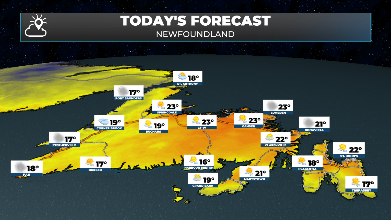
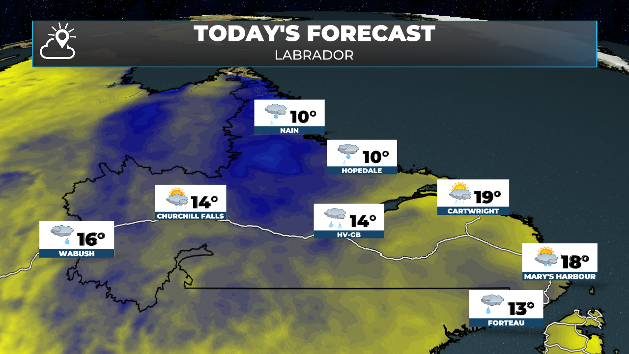
Showers continue in Labrador today, while the weather on the Island improves. There may be an isolated shower or two over western Newfoundland later today.
Highs reach the 20s on the Island and teens to near 20 in Labrador.
Tuesday looks sunny and summer-like across NL with the next weather-maker arriving Wednesday.
A very typical weather pattern sets up shop this week across the region with broad, humid southwest and southerly flow bringing warm temps to much of NL, except for areas in onshore southerlies where fog and drizzle will be common.
This morning’s update is sponsored by Roebothan, McKay, Marshall.

Visit MakeTheCall.ca today to learn more about how the law firm can help you!
Showers continue across Labrador today, while the weather on the Island trends in the right direction. The morning drizzle and fog over the Avalon is wrapping up, with clearing skies behind it this afternoon. That said, I can't rule out an isolated shower or two over western Newfoundland later today, so keep that in mind if you've got outdoor plans on the west coast. It'll also be a breezy one, with southwesterlies gusting 40 to 50 km/h for many, and up to 70 along parts of the west coast this afternoon.
Temperature-wise, highs reach the 20s on the Island today — Eastern areas top out near 23 with a humidex of 27 — though it'll be closer to the mid-teens along parts of the coast and in areas that hang on to the cloud cover longer. Across the Big Land, expect highs in the teens to near 20.
Tuesday is the pick of the week, hands down. Sunny and summer-like right across Newfoundland and Labrador, with highs in the mid-20s for most — 25 in St. John's and 24 for Corner Brook, feeling closer to 27 with the humidity. Any early fog patches burn off in the morning. Get out and enjoy it!
The next weather-maker arrives Wednesday, with clouds increasing through the day and showers moving in Wednesday night into Thursday, starting out west and spreading east.
Bigger picture: a very typical mid-summer pattern sets up shop this week across the region. Broad, humid southwest and southerly flow will keep warm temps in place for much of NL through the week. The exception, as always, will be areas stuck in onshore southerlies, where fog and drizzle will be common — a story we know all too well this time of year.
Have a great start to the week!
My next update will be posted later today!
FIND ME ON SOCIAL!
