
Friday Morning Weather Brief — October 10, 2025
Good Friday morning!
The cold air has swept in, and temperatures are much cooler across the Island this morning compared to 24 hours ago. Most locations are in the lower half of the single digits, with wind chills near or below freezing. Temperatures in Labrador aren’t much different, but wind chills are lower. As of 5:32 AM NDT (5:02 ADT), the lowest wind chill I spotted was Hopedale at -6.
This morning’s update is sponsored by Roebothan, McKay, and Marshall.

Visit MakeTheCall.ca to learn more about what the law firm can do for you.
On top of the cooler air, we are still left with lingering showers this morning for a good chunk of the Island. As of just before 6 AM both Gander and St. John’s International Airports are reporting light rain showers. I do suspect that some areas of central may have some wet flakes mixed in with those rain showers at this early hour.
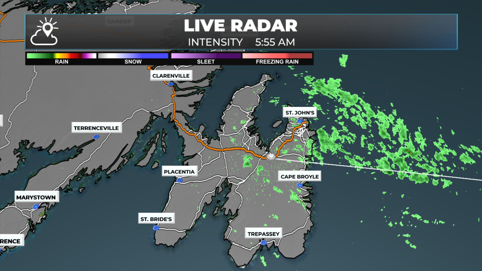

On the Island today, we will see the showers this morning end, giving way to a mix of sun and cloud for most areas. Showers will continue along and near the West Coast, with chances approaching 100% late this afternoon and evening. In fact, there will be a period of rain for much of the West Coast and GNP this evening. Temperatures today peak in the single digits to lower teens.

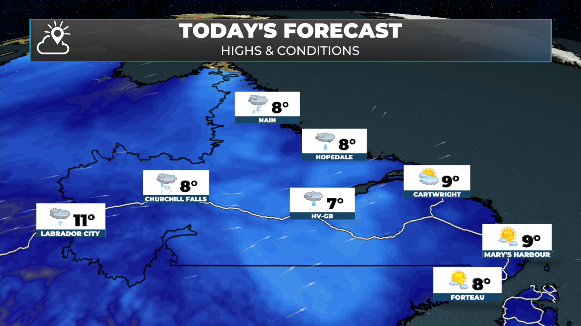
Parts of Labrador are waking up to snow this morning. Wabush Airport is reporting snow as of 4:53 AM ADT and has been for the last few hours. Fortunately, the visibility has remained relatively high, meaning the snow is light. The webcam from the TCH in Wabush shows a wet road with some snow on the sides.
The snow we are seeing in parts of Labrador this morning will end from west to east throughout the morning. In some of the lower elevations, the snow will be mixed with rain, or just plain old rain will fall. The disturbance driving this will push the rain towards Happy Valley-Goose Bay, southeast Labrador, and eventually the Northern Peninsula and West Coast of the Island later today and this evening. Future radar shows this very well.
Temperatures across the Big Land today will be similar to the last couple of days, with highs in the single digits to lower teens. While there will be some snow this morning in spots along the TLH, I do not expect it to impact travel on a widespread scale because the temperature will mostly be above freezing. In fact, the snow today is along and ahead of the warm front, so once it ends, expect a rise in temperatures.
The weekend is looking fairly… okay across the Province. There will be some showers around Saturday, followed by more sunshine on Sunday. As we look ahead toward next week, a large high will stall over the region, keeping the dry weather in play and at the same time keeping a potent nor’easter south of the region. I’ll have my next update on this and more later today. Be sure to follow along on socials and the app for more frequent updates!