
Friday Morning Weather Brief — November 7, 2025
COASTAL FLOOD STATEMENTS & STORM SURGE WARNINGS REMAIN IN EFFECT.
...
COASTAL FLOOD STATEMENTS & STORM SURGE WARNINGS REMAIN IN EFFECT. ...
Good Friday morning!
The weather across Newfoundland and Labrador is expected to improve today compared to the last couple of days, as no new storms are forecasted to move in. That being said, we are seeing some slippery roads in parts of the Island due to last night’s snow. Looks like St. John’s International measured the first 5 cm of the season.

Visit MakeTheCall.ca to learn more about what the law firm can do for you.
We are seeing a few areas of rain and snow showers over the western and central regions this morning, as well as rain and snow along the Labrador Coast. Largely, the weather on the Island will improve, and while it will be breezy again today, it shouldn’t be as windy as the last couple of days for most areas. I cannot say the same about coastal Labrador, where rain and snow are expected to persist into Saturday.
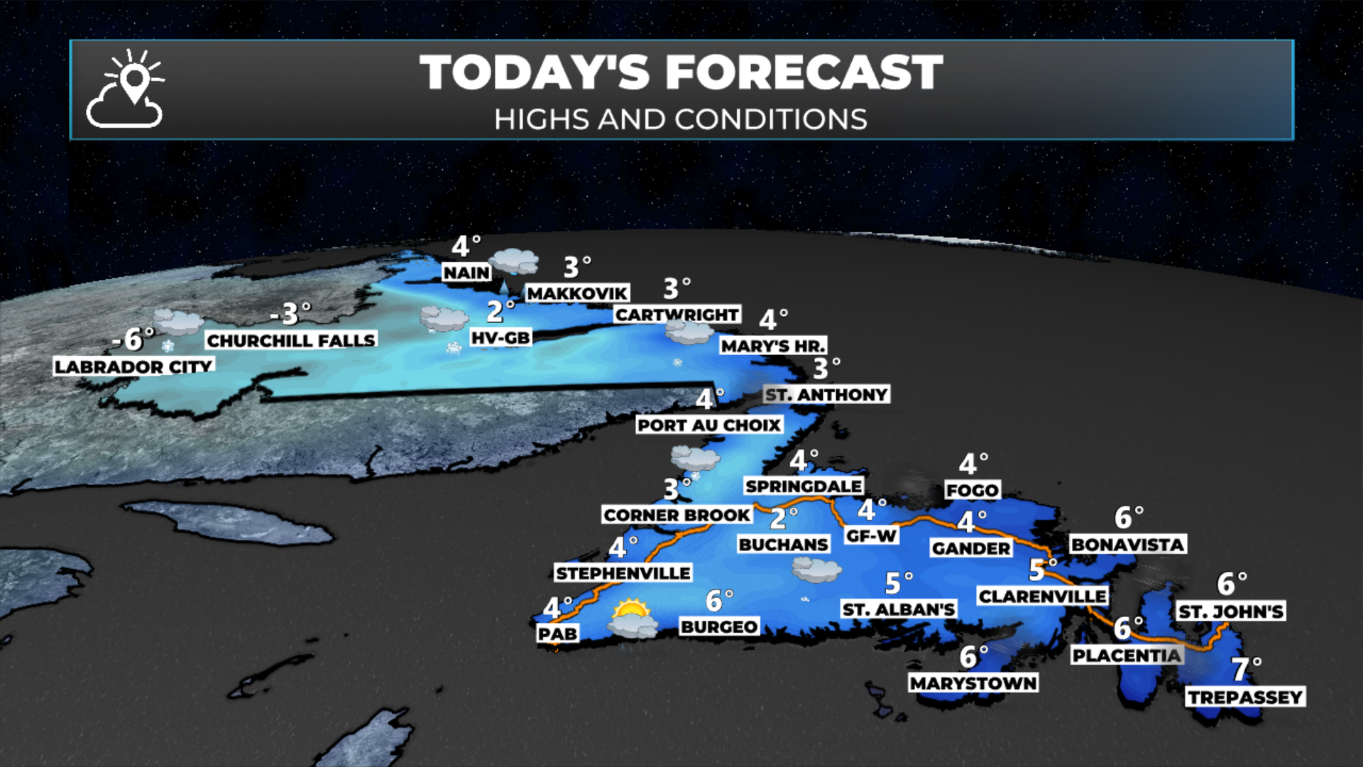
Today’s forecast | November 7, 2025
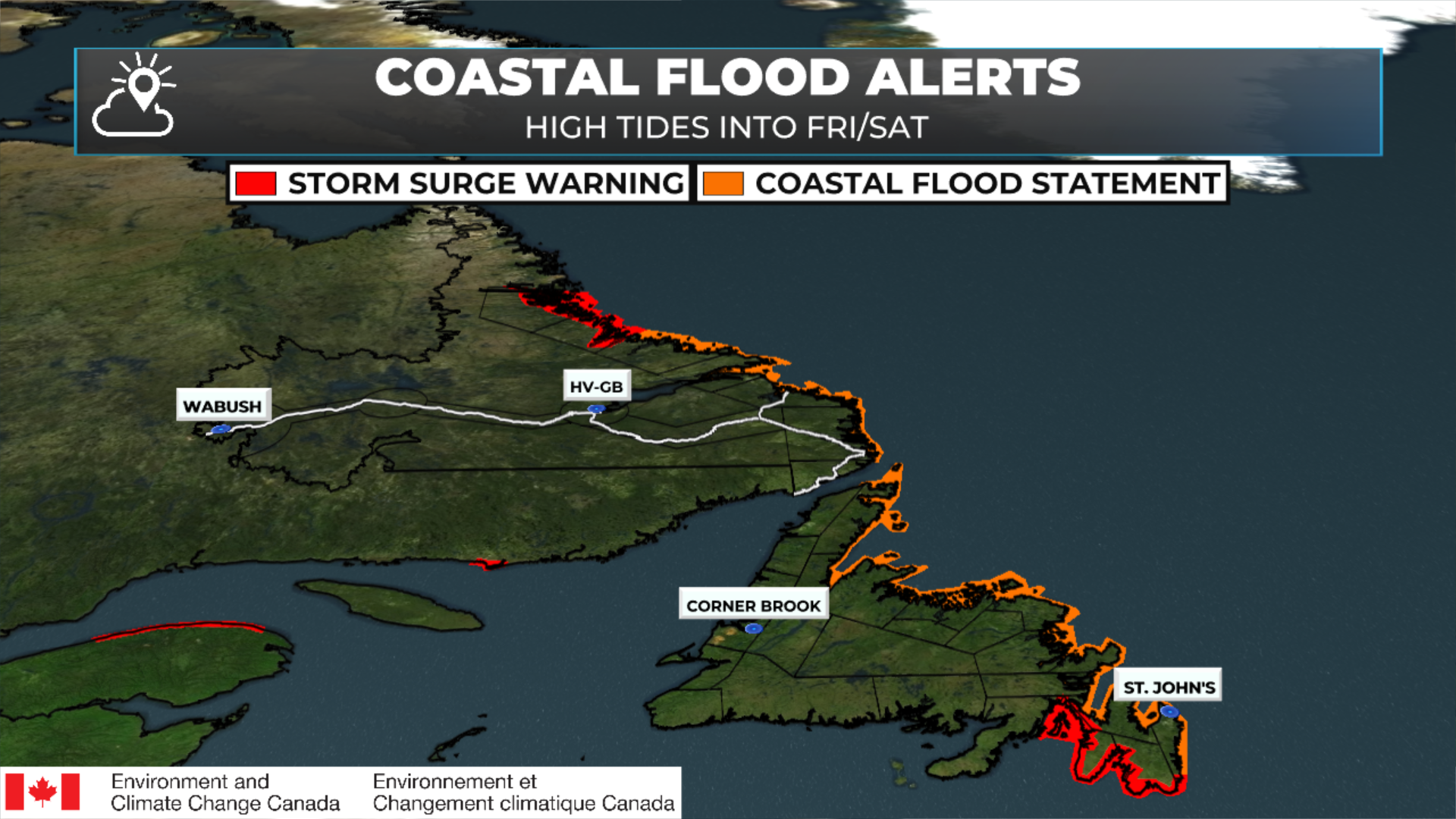
Coastal Flood Alerts | November 7, 2025 @ 6:44 AM NST
Storm Surge Warnings and Coastal Flood Statements remain in effect through this morning’s high tide on the Island. It appears that areas from the Southern Shore to Bonavista Bay (east and north-facing shores) may see as much as 60 cm (2 feet) of storm surge with the morning high tide.
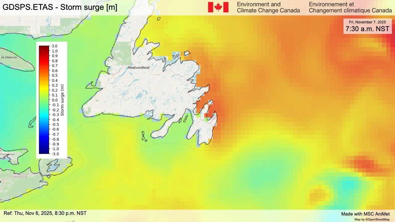
Storm Surge Forecast for this morning | Height of water ABOVE the tide (November 7, 2025)
Beyond that, no major weather moves in today… We can breathe a decent sigh of relief. For now.
Have a great Friday! I’ll have my next update this afternoon.