
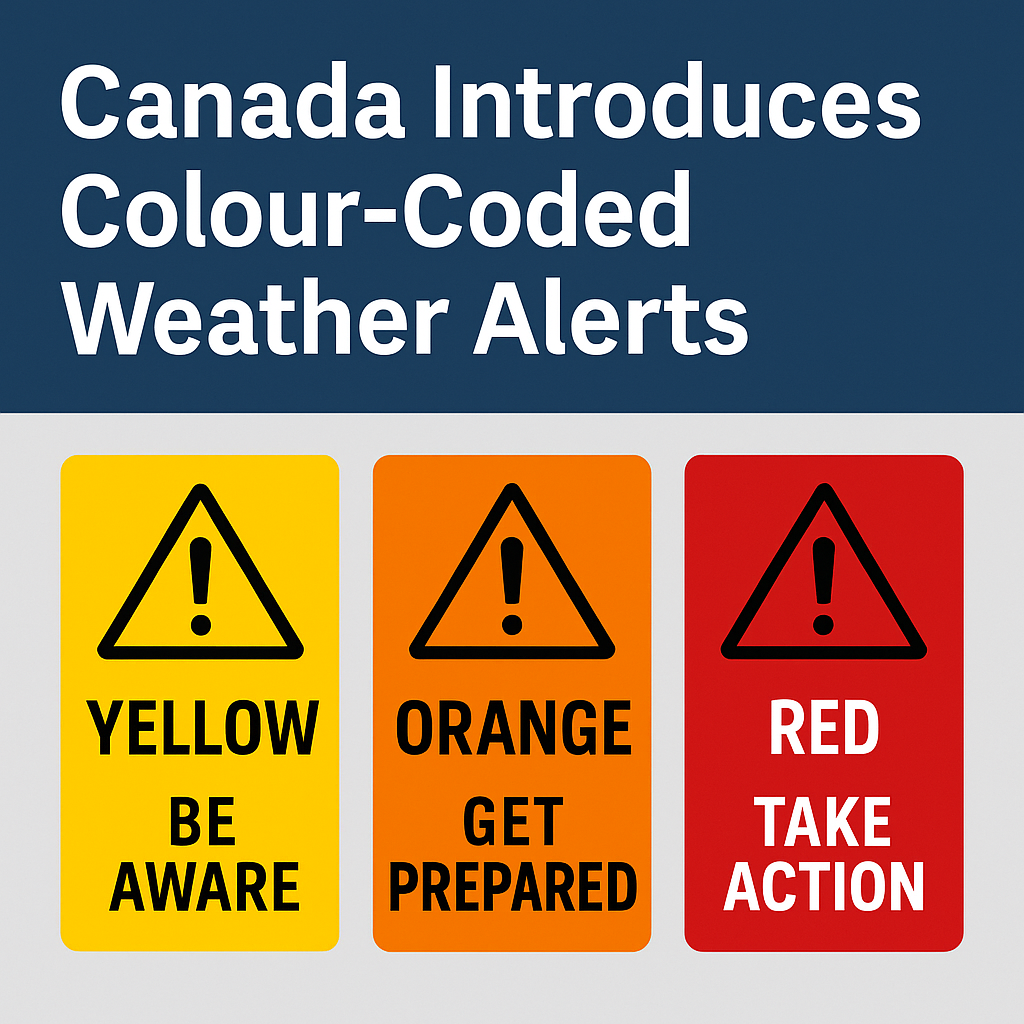
Canada Introduces Colour-Coded Weather Alerts: Here’s What You Need to Know
Environment and Climate Change Canada has officially rolled out a brand-new way for Canadians to understand weather alerts — and it’s hopefully going to make things clearer during high-impact weather events.
As of November 26, 2025, all watches, warnings, and advisories across the country will follow a colour-coded system designed to help you quickly understand the severity, likelihood, and potential impact of upcoming weather.
This isn’t just a cosmetic change. It’s part of a national push toward impact-based alerting, which focuses less on “how much snow or wind” and more on “what this weather could do to you, your property, and your community.”
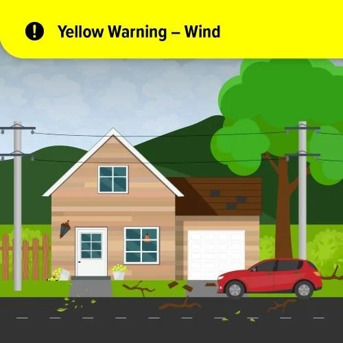
Example of a Yellow Warning for Wind
🟡 Yellow Alerts – Be Aware
Yellow means conditions may cause some level of damage or disruption.
Impacts are generally moderate, often localized, and typically short-lived.
This might include things like:
Slippery roads
Minor tree damage
Spotty power flickers
Localized flooding in poor-drainage areas
A yellow alert is your cue to pay attention. Yellow alerts are the most common.

Example of an Orange Warning for Wind
🟠 Orange Alerts – Get Prepared
Orange alerts signal that significant impacts are likely. These events can cause disruption that may last a day or more, and they often cover a larger geographic area.
Examples might include:
Multiple power outages
Travel delays or cancellations
Widespread wind damage
Coastal impacts
Dangerous winter driving conditions
An orange alert is all about readiness. Secure outdoor items, review your storm plan, and think about whether travel is actually worth it. Orange alerts are uncommon.
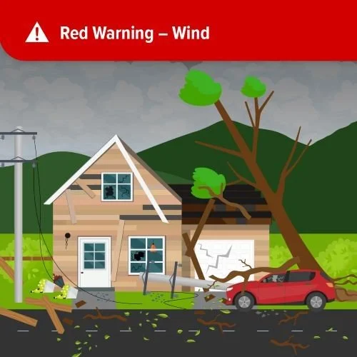
Example of Red Warning for Wind
🔴 Red Alerts – Take Action
Red alerts are reserved for the highest-risk, life-threatening situations.
This is weather that can cause:
Major destruction
Prolonged utility outages
Dangerous conditions for travel or being outdoors
Serious threats to health and safety
Red means do what you need to do to stay safe, and do it now.
These alerts are rare — but when they’re issued, they matter.
⚠️ Why Change the System?
Weather impacts vary across the country. The same storm can do very different things depending on terrain, population, infrastructure, and where you happen to be.
The new colour-coded system helps:
Make alerts more consistent nationwide
Improve public understanding at a glance
Highlight the impact, not just the weather type
Give people clearer cues on when to prepare and when to act
This is about making the alerts easier to understand and more relevant to you.
What This Means for Newfoundland & Labrador
For NL — where a “breeze” on the coast can be 90+ km/h and a snow/rain line can dance back and forth like it has its own personality — this system could actually help cut through some of the confusion.
Seeing yellow vs. orange vs. red helps you quickly know:
Is this just a nuisance event?
Is this something that will disrupt my day?
Or is this something I genuinely need to prepare for?
I’ll keep breaking these down for you in plain language whenever they appear — just like always. Different colour, same impact: helping you know what’s coming.
To see how the alert types are chosen, follow this link.
To see why alerts are issued, follow this link.
Be sure to get the app if you haven’t already.