
Wednesday Morning’s Weather Briefing — March 25, 2026
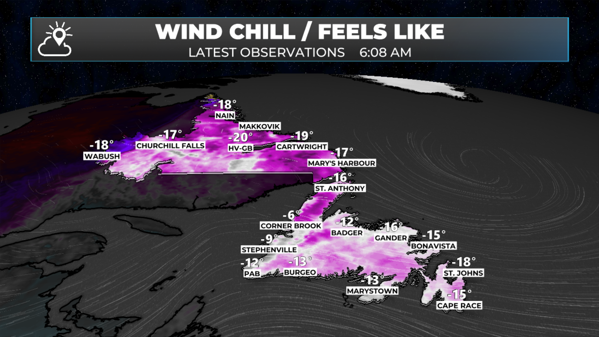
Wind chills as of 6:08 AM NDT on March 25, 2026
Good Wednesday morning!
Here are today’s weather highlights:
Our latest winter storm departed into the North Atlantic overnight and in its wake its ’s quieter, colder and breezy.
Expect a mix of sun and cloud for most areas of NL today, with scattered flurries and/or snow showers this afternoon as a weak disturbance moves across Newfoundland.
While not much snow is expected today with this little system, the snow that does fall could be briefly intense over southern, interior, central and western Newfoundland today and the Avalon and Burin Peninsulas this evening. Remember, you can use the Radar+ page in the app to track these areas of snow yourself!
Highs reach the single digits above and below freezing on the Island today and minus single digits to minus teens in the Big Land.
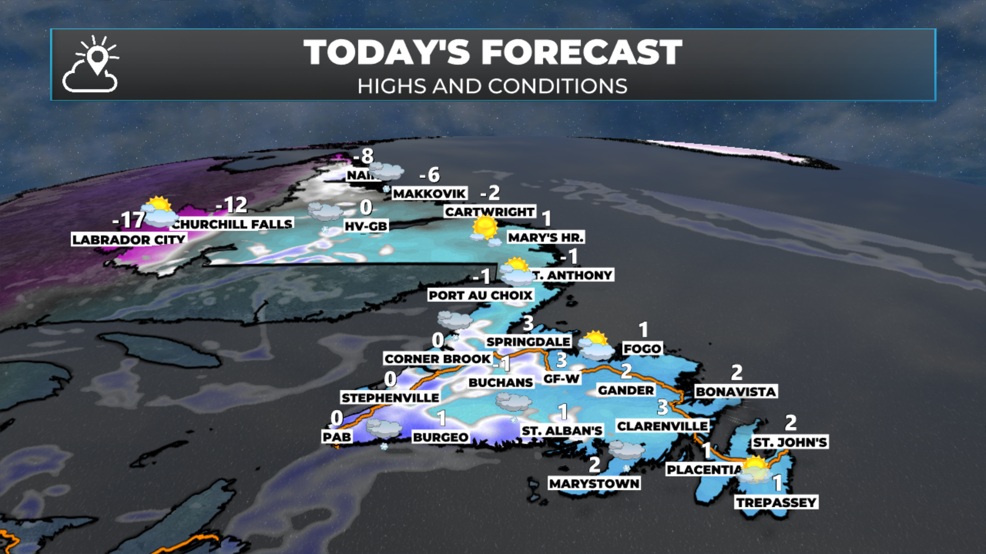
Today’s forecast for Newfoundland and Labrador. March 25, 2026
The only issue across the region today will be some flurries and snow showers that move through with a weak disturbance. These will start on the South Coast, West Coast, and throughout Interior, Central and northeastern Newfoundland, along with the Northern Peninsula and eastern Labrador between late this morning and the early afternoon. The Burin and Avalon Peninsula and even parts of eastern Newfoundland will see this work throughout later today or this evening. The animation below shows that well. Snowfall with this will not be significant, but rates will be high enough to bring locally stormy conditions for short periods of time.
Outside of these, the weather across NL today will be on the quiet side. That changes tomorrow and Friday as another low is set to move through. This low will track through the Gulf of St. Lawrence and bring snow to much of Labrador and a mix of rain and snow ot the Island between Thursday night and midday Friday. There will also be wind with this. I’ll have an update on what we can expect later today.

FIND ME ON SOCIAL!