
Friday Morning’s Weather Briefing — May 29, 2026
Good Friday Morning! The fog is back.
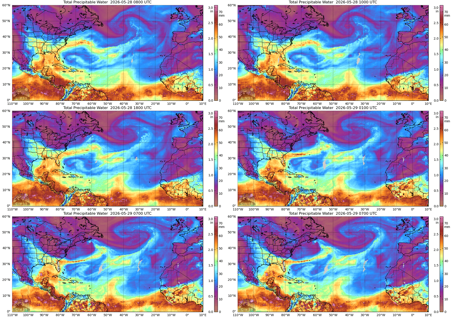
This animation shows how moisture from a low to our east and south is being funneled toward eastern NL, leading to more fog and drizzle than the last couple of days.
This morning’s update is sponsored by Roebothan, McKay, Marshall.

Visit MakeTheCall.ca today to learn more about how the law firm can help you!
Here are today’s highlights:
Temps are in the single digits above freezing as we start the day across the Province.
There is more low cloud, fog, and drizzle this morning for Newfoundland’s north and east-facing shores, along with coastal Labrador.
Drizzle and fog will be the rule today for the eastern parts of the Province. Rain will also fall along parts of the South Coast today.
Rain becomes widespread over central and eastern Newfoundland tonight, along with the Northern Peninsula. Wet snow will fly in the higher terrain of Green Bay – White Bay.
Things improve for much of the Province Saturday, except east and northeast, where it remains foggy, drizzly and breezy.
Potential is still hanging around for wet snow on Monday in the east – Monday is June 1. 🙄
NEWFOUNDLAND’S OUTLOOK
The northeast flow that has had eastern and central Newfoundland in its grip all week is still very much in charge this morning. Fog has redeveloped or become a bit thicker in parts of eastern, northeast, and central Newfoundland. Especially along and near the coast. St. John’s International is reporting a visibility of just 600 metres as of 5:30 AM.
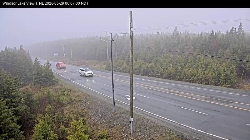
View of Portugal Cove Road near Airport Heights in the City of St. John’s at 6:07 AM NDT
For the Island today, the Avalon starts with fog, low clouds, and drizzle, with showers developing by this afternoon as the latest moisture push tracks in from the east/northeast — highs only reach 5°C under a persistent grey sky. Central and northeast Newfoundland are in a similar situation, with drizzle and possible flurries throughout the day; that northeast fetch is cold enough at this time of year to squeeze some frozen precip out of the clouds.
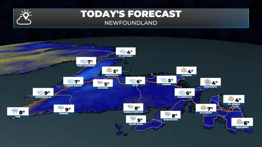
Newfoundland’s forecast for today – May 29, 2026.
One thing worth flagging for tonight is a risk of freezing drizzle in the Green Bay-White Bay area, with the possibility of a couple of centimetres of snow inland over higher terrain from our incoming low-pressure centre. The West Coast/GNP stays mostly dry today, with highs near 6°C. Rain and fog will be found along and near the South Coast this afternoon. Wind speeds Island-wide will be from the northeast at 20 to 40 km/h.
LABRADOR’S OUTLOOK
Much of the Big Land will see a warm day with lots of sunshine and temperatures reaching the lower teens. The exception will be along the coast, where onshore flow will keep temperatures near the lower single digits, and we will be dealing with areas of low cloud, fog and drizzle. The weather may impact air operations to and from the coast.
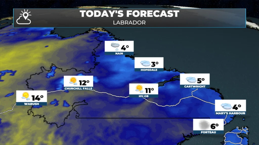
Labrador’s forecast for today – May 29, 2026
LOOKING INTO SATURDAY…
Saturday is worth circling if you’re in eastern/central Newfoundland and on the eastern side of the Northern Peninsula. Rain is likely, along with a lovely northeast wind ramping up to 30–50 km/h through the afternoon. There may even be some wet snow in the higher terrain in Green Bay – White Bay. Temperatures will be near 5ºC, but it will feel colder with the wind. The West/Southwest/South Coast will stay dry and see some sun! Labrador is looking at a mostly sunny Saturday, with highs in the single digits on the coast and in the teens inland and to the west.
STILL WATCHING MONDAY…
An area of low pressure will pass east of the Avalon between Sunday night and Monday. The position and strength of this low is such that it will bring another round of rain and wind to eastern Newfoundland. There is also the chance that some areas will see wet snow. At this point, accumulations don’t look significant, but the fact that I’m still writing about snow as we kick off June (Monday is June 1st) is wild. After Monday, it appears we get into a warmer pattern… with more seasonable temperatures in the longer-range forecast.
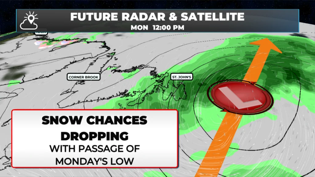
Watching Monday for the potential of wet snow in parts of eastern Newfoundland.
I’ll have my next forecast posted later today!
📱 Get the Sheerr Weather App in the Apple App Store and Google Play Store.
🗺️ Check out the Map Room to see all the latest weather observations for the Province.
🎥 Check out the Provincial Highway Cams to see 👀 what’s going on around our highways and
Excellent update Eddie
Good morning Eddie and thanks for the update, have a great day