
Friday Morning’s Weather Briefing — October 9, 2026

Good Friday Morning!
A cold front is moving across the Island this morning, and there are areas of rain and showers that stretch from the west coast through central and eastern Newfoundland.
That front will bring showers to the Avalon this morning before it moves offshore. The weather behind the front will clear out, and most of the Island will see a decent and breezy day.
Showers will persist on the West Coast and in parts of Labrador today.
Highs reach the teens on the island and single digits in the Big Land.
This morning’s update is sponsored by Roebothan, McKay, Marshall.
Visit MakeTheCall.ca today to learn more about how the law firm can help you!
A Mild, Breezy Start
A cold front is pushing across the Island this morning, and we're sitting in the warm air out ahead of it across the eastern half of the Island. That's why it's 13º at 5 AM in St. John's and Gander, which is a good 4 or 5 degrees above where we should be for early October. The south wind is doing the work, gusting 50 or so on the Avalon and up near 65 around Gander. Out on the South and Southwest, the front has already passed through, with winds around Port aux Basques now coming from the west and pressure starting to rise. That's your sign of what's coming for the rest of us.
Rain and showers are the main event this morning for the Avalon and Central, tapering off around noon with only a few millimeters of rain, along with patches of fog in the south. This is along and ahead of the cold front that will sweep offshore later this morning. The West Coast gets a break from the heavier rain overnight but stays showery, with a 40 to 60% chance of showers. Behind the front, the sun comes out over the South Coast and Northern Peninsula this afternoon, though it turns breezy out of the west and southwest.
Eastern Newfoundland / the Avalon
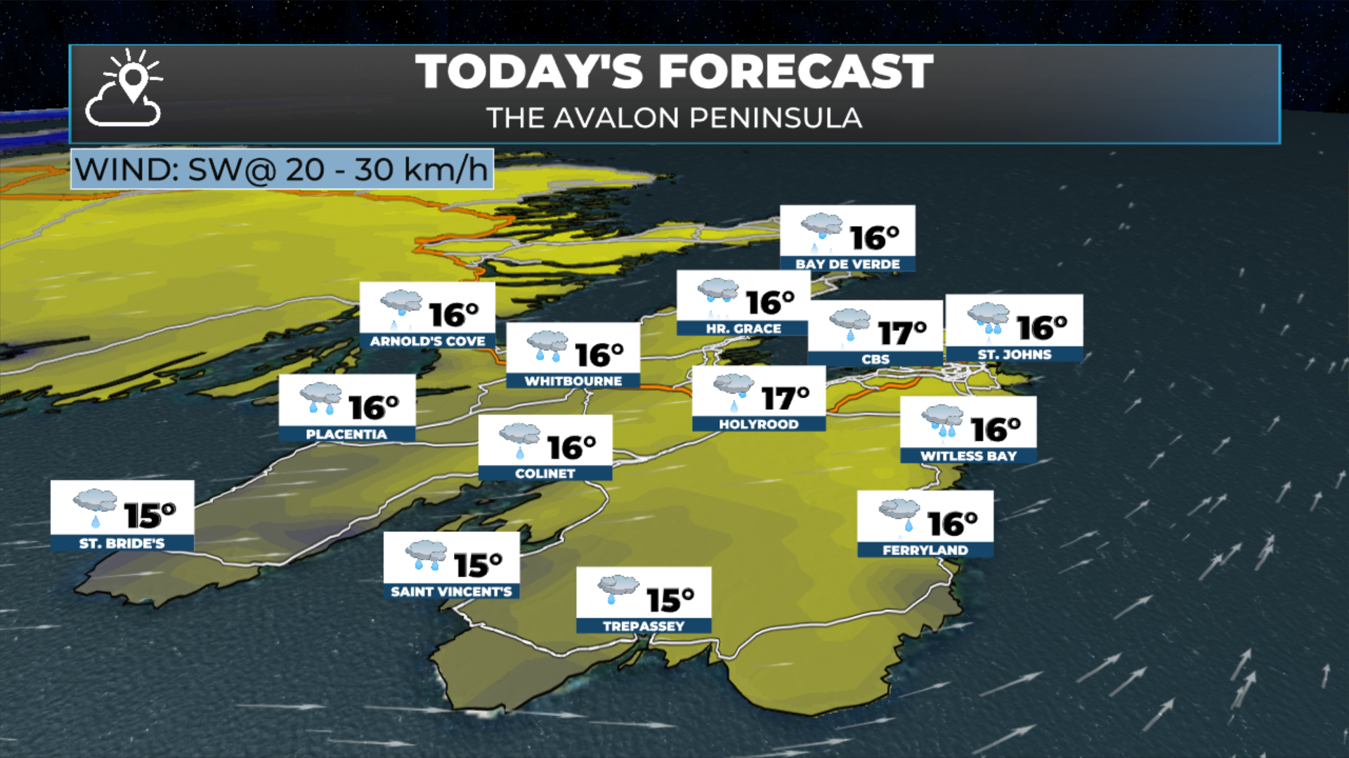
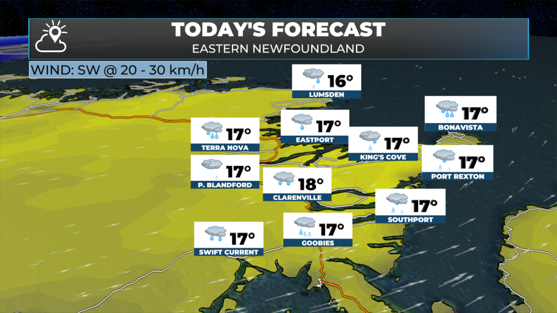
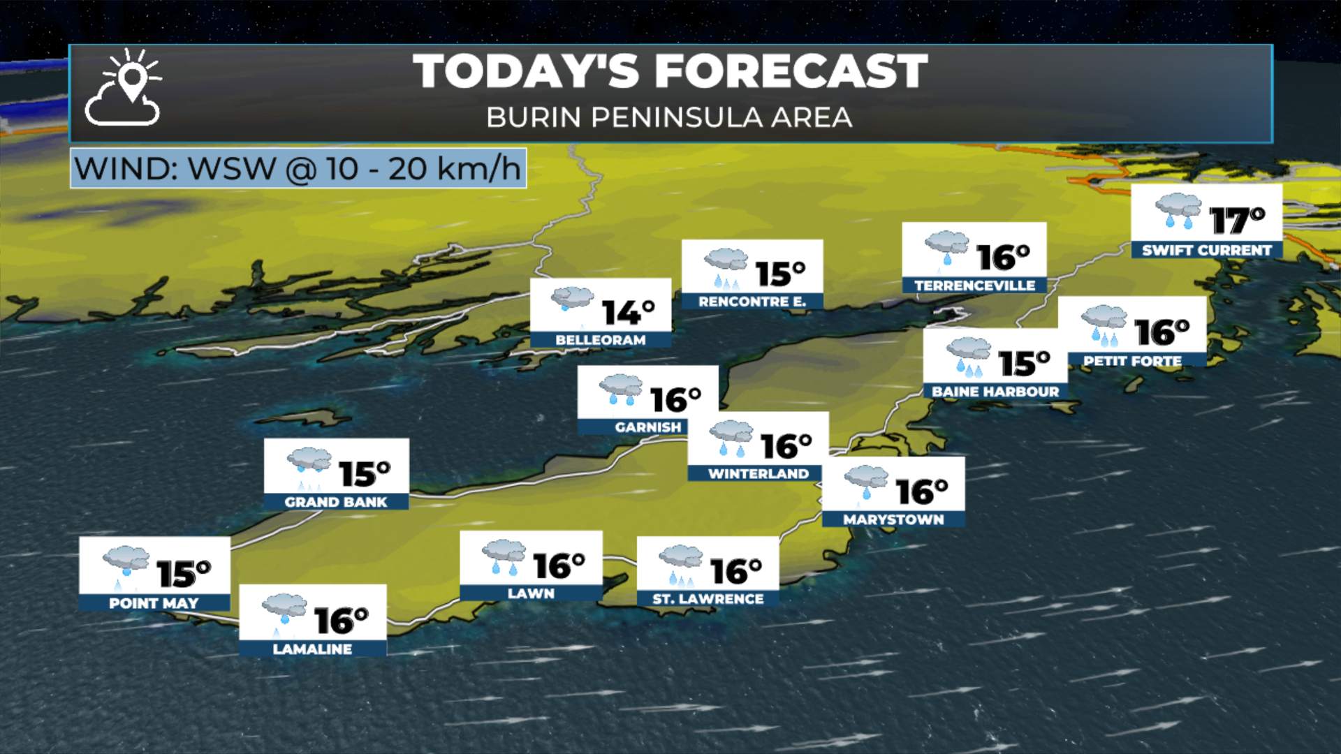
Rain this morning, tapering around midday, then clearing. Highs 14 to 18, warmest inland and coolest right along the coast. Gusty south winds this morning, then turning west. Gusts to 60 this morning, dropping to 40 later today.
Central
Rain ends around noon, then a mix of sun and clouds with a 40% chance of showers. Highs 15 to 16. Windy on the Northeast Coast this morning.
The West Coast
Showers on and off, with a 40 to 60% chance. Highs 11 to 14. It will be a little cooler in the higher terrain, with temperatures there only reaching the single digits this afternoon. Breezy with westerlies gusting to 50 km/h.
South/Southwest Coast
The morning rain clears, and we get some afternoon sun. Highs 12 to 15. West winds gusting in the 40 to 60 range from west or southwest throughout the day.
The Northern Peninsula:
Rain ends this morning, then sun and cloud. Highs 10 to 12, with southwest winds gusting to 50 km/h.
Labrador
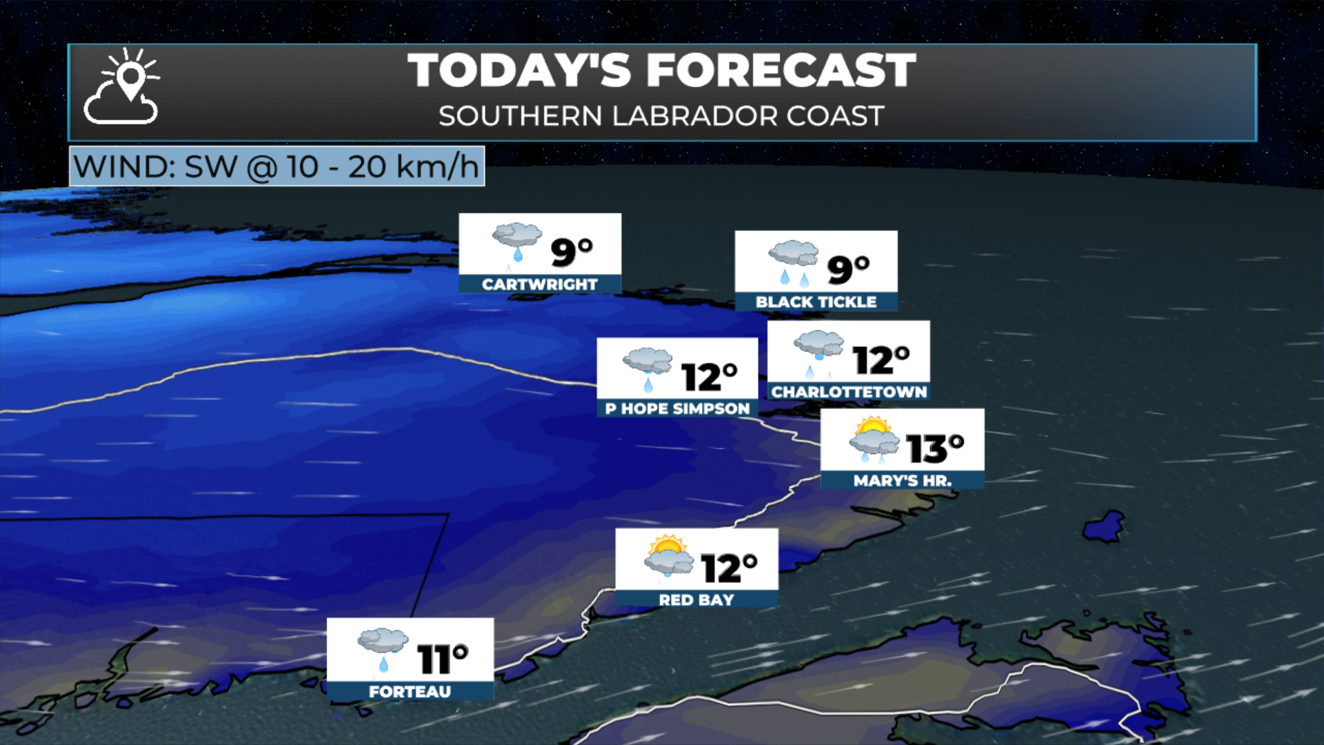
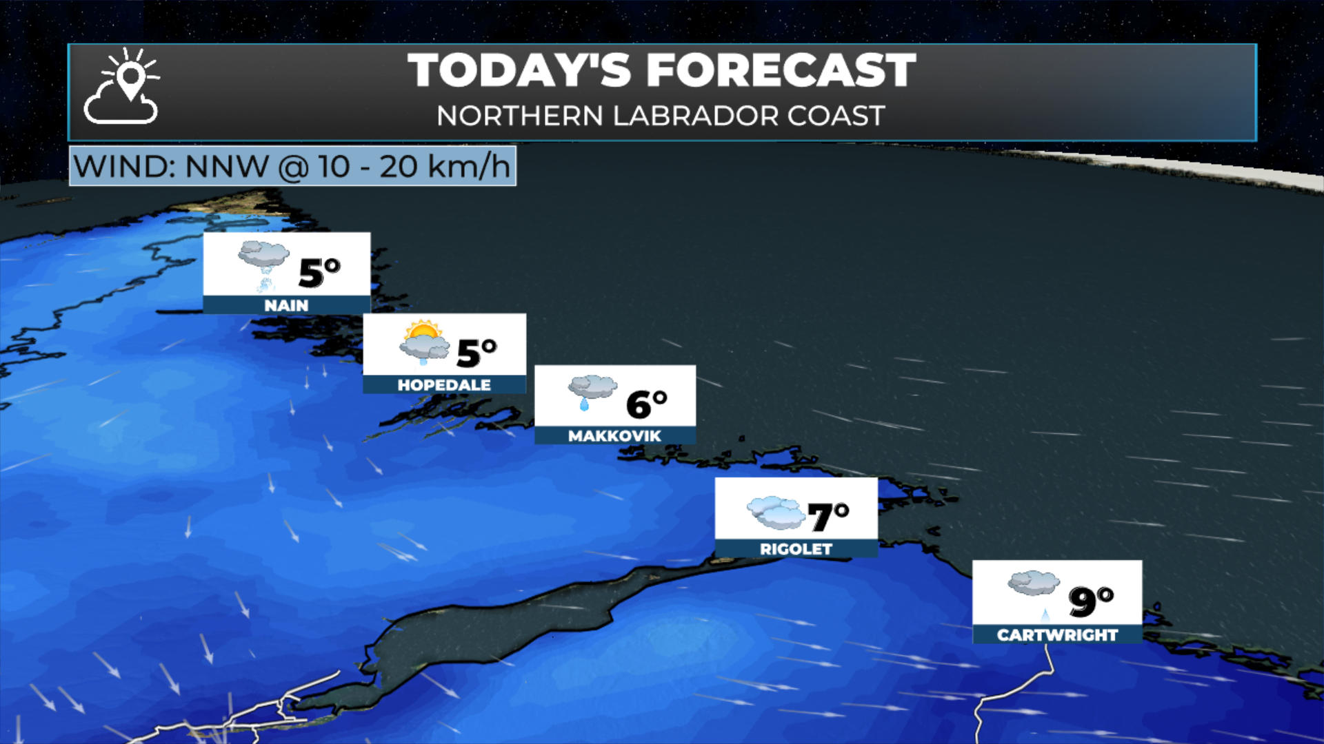
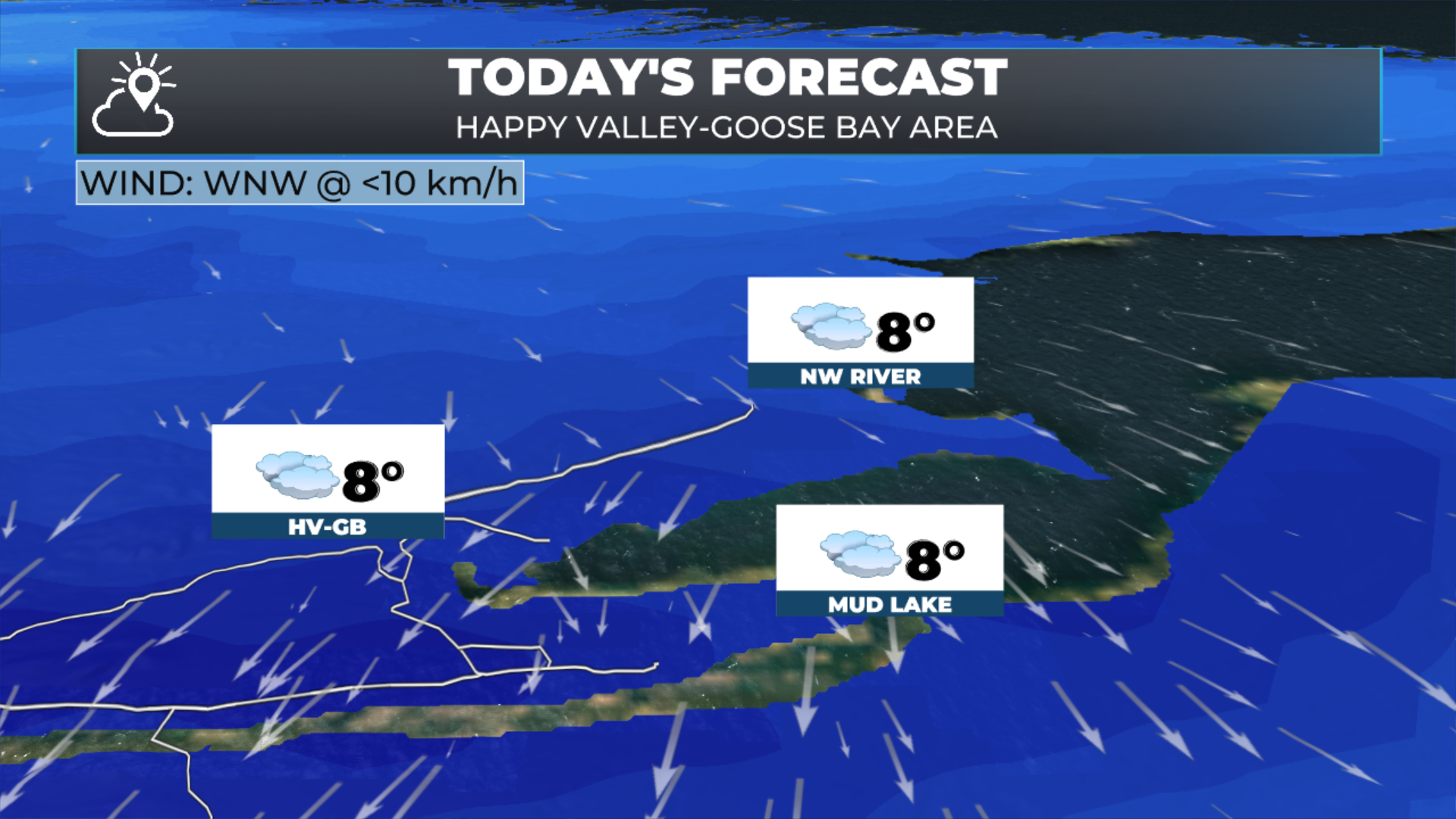
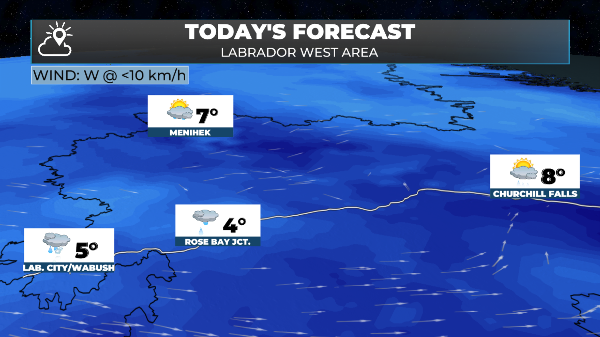
Cloudy and cool. Lab West is peaking near 6º with rain and snow showers, Goose Bay climbs to around 8, and the North Coast is 4 to 6 with morning showers and flurries near Nain. Heads up, snow becomes likely in Lab West on Sunday.
FIND ME ON SOCIAL!
